


A new project uses historical records to reconstruct what Columbus neighborhoods looked like before freeways displaced them.
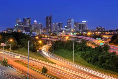
An Ohio State University project known as “Ghost Neighborhoods of Columbus” reconstructs the vibrant communities that once existed in the city before freeways tore through them through 3D imaging, prompting deeper questions such as “How much wealth-generating activities were lost? How many homes? How many institutions?” Mark Ferenchik, writing in the Columbus Dispatch, describes the project. “When you can visualize it, it really takes your breath away,” says project lead and professor Harvey Miller.
The researchers used old fire insurance maps from between 1897 and 1961 as well as historical photographs to reconstruct long-gone neighborhoods with accuracy. They are also interviewing residents who lived in these areas about their experiences. “Based on the OSU research, in Driving Park alone, the losses to the freeway system amounted to 286 houses, 86 garages, five “flats” (apartments), and three businesses.”
Today, some cities, states, and the federal government are beginning to recognize and attempting to redress the damage caused by rampant freeway construction by demolishing or repurposing urban roadways. The federal Reconnecting Communities Act, for example, provides $1 billion for highway removal projects around the country (though it should be noted that the program was whittled down from the originally proposed $20 billion).
FULL STORY: Columbus neighborhoods cut up by freeways being reimagined by Ohio State researchers in 3D


Santa Monica Offers Affordable Housing to Residents Displaced by Freeway Construction
A new program seeks to make restitution for the damage inflicted on Black communities by highway construction and urban renewal.
Bridging Divides: The Crucial Role of Collaboration in Highway Removal
Highway removal is most successful when agencies at all levels of government work closely with each other and the impacted community.
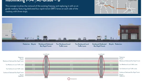
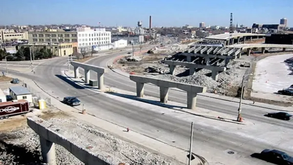
More Options Presented for Minneapolis I-94 Project
Two new proposals for replacing the freeway with at-grade segments offer new visions for the future of downtown Minneapolis.

National Parks Layoffs Will Cause Communities to Lose Billions
Thousands of essential park workers were laid off this week, just before the busy spring break season.

Retro-silient?: America’s First “Eco-burb,” The Woodlands Turns 50
A master-planned community north of Houston offers lessons on green infrastructure and resilient design, but falls short of its founder’s lofty affordability and walkability goals.

Delivering for America Plan Will Downgrade Mail Service in at Least 49.5 Percent of Zip Codes
Republican and Democrat lawmakers criticize the plan for its disproportionate negative impact on rural communities.

Test News Post 1
This is a summary

Test News Headline 46
Test for the image on the front page.

Balancing Bombs and Butterflies: How the National Guard Protects a Rare Species
The National Guard at Fort Indiantown Gap uses GIS technology and land management strategies to balance military training with conservation efforts, ensuring the survival of the rare eastern regal fritillary butterfly.
Urban Design for Planners 1: Software Tools
This six-course series explores essential urban design concepts using open source software and equips planners with the tools they need to participate fully in the urban design process.
Planning for Universal Design
Learn the tools for implementing Universal Design in planning regulations.
EMC Planning Group, Inc.
Planetizen
Planetizen
Mpact (formerly Rail~Volution)
Great Falls Development Authority, Inc.
HUDs Office of Policy Development and Research
NYU Wagner Graduate School of Public Service