


The MBTA Communities law sets ‘minimum multi-family unit capacity’ for communities located near transit stations to boost higher-density housing development in transit-rich areas.

Writing in Commonwealth Magazine, Amy Dain explains Massachusetts’ new MBTA Communities law, which requires “cities and towns served by the MBTA (outside of Boston) to zone a district “of reasonable size” for multi-family housing near MBTA stations, where practical.”
Dain describes the measure used by the state to calculate ‘reasonable size,’ what the state calls “minimum multi-family unit capacity” or zoning capacity. “If you draw a zoning district for multi-family housing (defined as buildings with three or more dwelling units) on a municipal zoning map, you can add up how many housing units in multi-family buildings could theoretically and maximally be built on every existing parcel in the district, based on what the zoning allows, regardless of what exists on each parcel or what the market might favor for each parcel. This count yields the zoning capacity of the district for multi-family housing,” Dain writes.
Notably, “Zoning capacity is not a home production goal,” but “a legal envelope of allowed buildings; an estimated count of technically allowed dwelling units.” Requirements for each community will vary based on the type of transit present, existing density, and other factors. “A district that is reasonable in one city or town may not be reasonable in another city or town, the guidelines explain.”
FULL STORY: What the MBTA Communities law means for your town


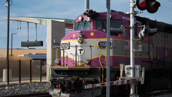
Massachusetts TOD Law Yielding Results
While some cities are fighting the state’s push to increase density near transit, others are already breaking ground on multifamily projects that will bring hundreds of new housing units online.

Experts Say Zoning Reform Isn’t Likely to Solve Housing Crisis
A survey by Fannie Mae found widespread skepticism among housing experts that zoning reforms will be enacted widely enough to make a major impact on U.S. housing supply.
Second Massachusetts Town Spurns State TOD Zoning Mandate
Marshfield residents voted down a rezoning plan that would have met state requirements for the town to allow development of multifamily housing near MBTA stations.

National Parks Layoffs Will Cause Communities to Lose Billions
Thousands of essential park workers were laid off this week, just before the busy spring break season.

Retro-silient?: America’s First “Eco-burb,” The Woodlands Turns 50
A master-planned community north of Houston offers lessons on green infrastructure and resilient design, but falls short of its founder’s lofty affordability and walkability goals.

Delivering for America Plan Will Downgrade Mail Service in at Least 49.5 Percent of Zip Codes
Republican and Democrat lawmakers criticize the plan for its disproportionate negative impact on rural communities.

Test News Post 1
This is a summary

Test News Headline 46
Test for the image on the front page.

Balancing Bombs and Butterflies: How the National Guard Protects a Rare Species
The National Guard at Fort Indiantown Gap uses GIS technology and land management strategies to balance military training with conservation efforts, ensuring the survival of the rare eastern regal fritillary butterfly.
Urban Design for Planners 1: Software Tools
This six-course series explores essential urban design concepts using open source software and equips planners with the tools they need to participate fully in the urban design process.
Planning for Universal Design
Learn the tools for implementing Universal Design in planning regulations.
EMC Planning Group, Inc.
Planetizen
Planetizen
Mpact (formerly Rail~Volution)
Great Falls Development Authority, Inc.
HUDs Office of Policy Development and Research
NYU Wagner Graduate School of Public Service