


The growth of transit-oriented development in the Cleveland region is being hindered by zoning codes that limit housing density and excessive parking requirements that drive up construction costs, new research suggests.
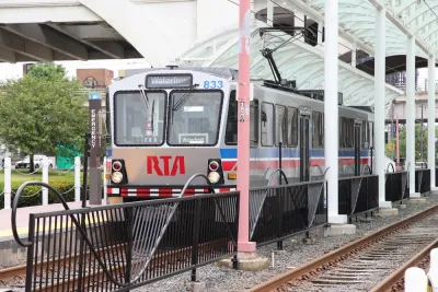
“New research by the Cuyahoga County Planning Commission offers fresh evidence that Cleveland and surrounding suburbs would be smart to rezone transit corridors to encourage dense, walkable, transit-oriented development, or TOD,” reports Steven Litt for Cleveland.com.
While market demand for transit-oriented development in Cleveland is growing, in many cases, developers still have to go through a cumbersome and expensive process to get permits to build TOD. “The data show that between 2012 and 2021, some 383 new developments added nearly $3 billion in real estate value through new construction or building renovations in the transit corridors.”While not every project is ‘transit-friendly,’ the study’s authors say “the new wave of development shows that to a significant extent, transit-oriented development is already happening in the core of the region because the market is demanding it.”
The research is part of an initiative to encourage transit-oriented development and assess how zoning changes can stimulate more housing production near transit lines. The four-phase project “will include identifying areas that could be targeted for transit-oriented development, drafting model codes, and identifying financial mechanisms and incentives.”
According to the study, the momentum for boosting development along transit in many Cleveland suburbs is stymied by outdated zoning codes and parking requirements, as well as disparate regulations among different suburbs. The authors suggest that Cuyahoga County could help suburbs develop their zoning plans with an eye to housing development, connectivity, and walkability. For its part, the county sees TOD as “an opportunity to add population and rebuild the tax base after decades of sprawl sapped its strength.”


New TOD Breaks Ground in Atlanta Area
The project will include over 500 housing units, commercial and retail space, and park spaces.

California Law Bars Parking Mandates Near Transit
Local governments are prohibited from requiring parking spaces at new developments where transit is readily available.

Experts Say Zoning Reform Isn’t Likely to Solve Housing Crisis
A survey by Fannie Mae found widespread skepticism among housing experts that zoning reforms will be enacted widely enough to make a major impact on U.S. housing supply.

National Parks Layoffs Will Cause Communities to Lose Billions
Thousands of essential park workers were laid off this week, just before the busy spring break season.

Retro-silient?: America’s First “Eco-burb,” The Woodlands Turns 50
A master-planned community north of Houston offers lessons on green infrastructure and resilient design, but falls short of its founder’s lofty affordability and walkability goals.

Delivering for America Plan Will Downgrade Mail Service in at Least 49.5 Percent of Zip Codes
Republican and Democrat lawmakers criticize the plan for its disproportionate negative impact on rural communities.

Test News Post 1
This is a summary

Test News Headline 46
Test for the image on the front page.

Balancing Bombs and Butterflies: How the National Guard Protects a Rare Species
The National Guard at Fort Indiantown Gap uses GIS technology and land management strategies to balance military training with conservation efforts, ensuring the survival of the rare eastern regal fritillary butterfly.
Urban Design for Planners 1: Software Tools
This six-course series explores essential urban design concepts using open source software and equips planners with the tools they need to participate fully in the urban design process.
Planning for Universal Design
Learn the tools for implementing Universal Design in planning regulations.
EMC Planning Group, Inc.
Planetizen
Planetizen
Mpact (formerly Rail~Volution)
Great Falls Development Authority, Inc.
HUDs Office of Policy Development and Research
NYU Wagner Graduate School of Public Service