


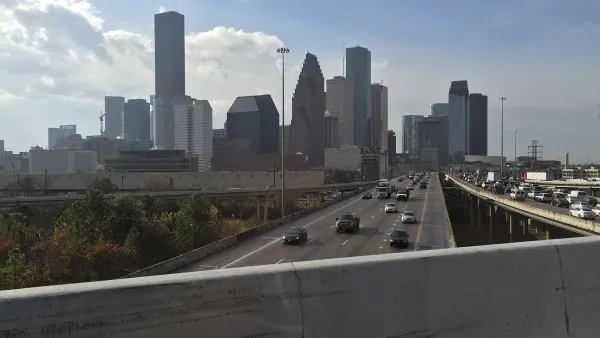
A chapter in a new book highlights how highway construction forced changes and caused displacement in communities that included public housing developments.

In an adapted excerpt from Justice and the Interstates: The Racist Truth About Urban Highways published in Next City, Kyle Shelton director of the University of Minnesota Center for Transportation Studies, describes the generational impacts of highway construction on communities and public housing developments in Houston, Texas.
“With every road widening, communities changed. Landscapes shifted. Routes to work and school were blocked. Homes and community institutions were displaced. Although the residents absorbed these impacts for generations, at no point have these Houstonians had the chance to meaningfully shape the highway projects that affect them.”
Shelton details the history of Clayton Homes and Kelly Village, which continue to face environmental hazards and reduced mobility. Yet the Texas Department of Transportation (TxDOT) is plowing ahead with the North Houston Highway Improvement Project (NHHIP), a freeway expansion that threatens to displace hundreds of homes and businesses.
Of course, “This story is repeated across the nation in highway-side communities, most of which are home to low-income and non-white residents. The highways set, in concrete, the course of decades of infrastructure development along with the same, ever-wider rights of way.”
Shelton argues that with many of the country’s major roads and highways aging, now is the time to reevaluate their role in the transportation system. “The choices cities, states, and the federal government make in the coming years can either exacerbate the negative impacts felt by highway-side residents or begin to center alternative approaches and transportation strategies that improve our collective mobility and address the wounds created by past decisions.”
FULL STORY: Houston’s Disruptive History Of Highways, And What Transit Agencies Can Do Better

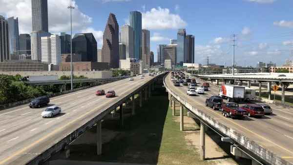
Contentious Houston Freeway Widening Project Inches Forward
Federal officials have given TxDOT the go-ahead to resume work on a small portion of a controversial interstate widening project in downtown Houston.

Proposed Park Yet Another Hurdle for Houston Interstate Expansion
The Interstate 45 widening project, halted by a federal order and opposed by many local officials and organizations, could hit a new snag if White Oak Bayou becomes a city park.
TxDOT Faces Lawsuit from Harris County Over I-45 Plan
The lawsuit over the controversial I-45 project, which has been plagued by local opposition, calls for a new environmental review.

National Parks Layoffs Will Cause Communities to Lose Billions
Thousands of essential park workers were laid off this week, just before the busy spring break season.

Retro-silient?: America’s First “Eco-burb,” The Woodlands Turns 50
A master-planned community north of Houston offers lessons on green infrastructure and resilient design, but falls short of its founder’s lofty affordability and walkability goals.

Delivering for America Plan Will Downgrade Mail Service in at Least 49.5 Percent of Zip Codes
Republican and Democrat lawmakers criticize the plan for its disproportionate negative impact on rural communities.

Test News Post 1
This is a summary

Test News Headline 46
Test for the image on the front page.

Balancing Bombs and Butterflies: How the National Guard Protects a Rare Species
The National Guard at Fort Indiantown Gap uses GIS technology and land management strategies to balance military training with conservation efforts, ensuring the survival of the rare eastern regal fritillary butterfly.
Urban Design for Planners 1: Software Tools
This six-course series explores essential urban design concepts using open source software and equips planners with the tools they need to participate fully in the urban design process.
Planning for Universal Design
Learn the tools for implementing Universal Design in planning regulations.
EMC Planning Group, Inc.
Planetizen
Planetizen
Mpact (formerly Rail~Volution)
Great Falls Development Authority, Inc.
HUDs Office of Policy Development and Research
NYU Wagner Graduate School of Public Service