


Existing hubs of ‘hyperlocal’ economic activity provide a model for urban density.

While the term “15-minute city” has been co-opted by conspiracy theorists to push baseless claims, a new concept may be taking its place. As Gaby Galvin writes in Smart Cities Dive, “as city leaders look to promote more sustainable growth, they’re relying on ‘activity centers’ — hyperlocal hubs of business, retail, tourism, civic institutions and social pursuits — to help people access everything they need with less or no driving.”
Although “Conventional wisdom suggests that greater population density translates to more walking, biking and public transit use, thus lowering carbon emissions from cars,” Galvin explains that “the relationship isn’t actually so straightforward, with local policies playing a major role, researchers say.” Now, policymakers in cities including Boise and San Antonio are looking to existing activity centers as a model for sustainable future development and identifying policies that will support dense, transit-oriented development.
According to Robert Puentes, president and CEO of the Eno Center for Transportation, “It’s less about just concentrating [homes and jobs] so that people can use transit to get to those parts of the region, [and more about] trying to concentrate more of the work and play around these activity centers.”
Adie Tomer, a senior fellow at Brookings Metro, cautions that activity centers, far from a panacea, can easily encourage more driving if built around sprawling shopping centers, for example. “Ultimately, identifying where activity centers are in a metro area is just one tool for city planners, developers and local officials as they map out the future of their regions.” Tomer adds, “The activity center framework ‘should help inform a sweeping set of decisions: Where do we want to prioritize development? How do we better understand which neighborhoods interact more with one another, so we can do certain investments in these places?’”
FULL STORY: Cities see hyperlocal ‘activity centers’ key to sustainable growth, less car dependency


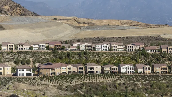
A Rapidly Urbanizing Texas County Gets in Touch With its Agricultural Roots
Developers in Fort Bend County are drawing inspiration from ‘agrihoods’ to build car-light communities in one of the nation’s fastest-growing areas.
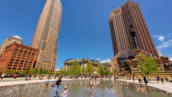
Cleveland Mayor Wants a 15-Minute City
The mayor of Cleveland expressed the goal to become the first “15-minute city” in America at his State of the City speech. Experts say it’s possible.
Study: How California Can Shift Away From Car-Oriented Development
While the state continues to rely on driving as a primary means of transportation, fighting climate change and the worsening housing crisis means implementing policies that encourage infill development, higher density, and public transit.

National Parks Layoffs Will Cause Communities to Lose Billions
Thousands of essential park workers were laid off this week, just before the busy spring break season.

Retro-silient?: America’s First “Eco-burb,” The Woodlands Turns 50
A master-planned community north of Houston offers lessons on green infrastructure and resilient design, but falls short of its founder’s lofty affordability and walkability goals.

Delivering for America Plan Will Downgrade Mail Service in at Least 49.5 Percent of Zip Codes
Republican and Democrat lawmakers criticize the plan for its disproportionate negative impact on rural communities.

Test News Post 1
This is a summary

Test News Headline 46
Test for the image on the front page.

Balancing Bombs and Butterflies: How the National Guard Protects a Rare Species
The National Guard at Fort Indiantown Gap uses GIS technology and land management strategies to balance military training with conservation efforts, ensuring the survival of the rare eastern regal fritillary butterfly.
Urban Design for Planners 1: Software Tools
This six-course series explores essential urban design concepts using open source software and equips planners with the tools they need to participate fully in the urban design process.
Planning for Universal Design
Learn the tools for implementing Universal Design in planning regulations.
EMC Planning Group, Inc.
Planetizen
Planetizen
Mpact (formerly Rail~Volution)
Great Falls Development Authority, Inc.
HUDs Office of Policy Development and Research
NYU Wagner Graduate School of Public Service