


Supporters of the waterfront park worry NYCDOT’s plan to potentially widen the Brooklyn-Queens Expressway could reduce green space in “one of the most expensive urban parks ever built.”
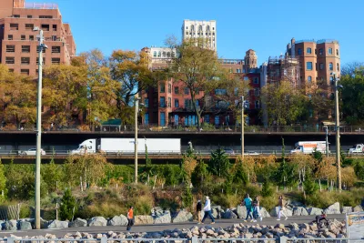
If the New York City Department of Transportation goes ahead with a proposal to expand the Brooklyn-Queens Expressway, known locally as the BQE, to three lanes in each direction, the road could cut into green space now part of the Brooklyn Bridge Park, reports Kevin Duggan for Streetsblog NYC.
The park, an 85-acre space completed between 2010 and 2021, is “one of the most expensive urban parks ever built” at $400 million. Former Traffic Commissioner San Schwartz and former Transportation Commissioner Hank Gutman both made public comments signaling their concern for the park and how an expanded highway footprint would damage the green space created by it.
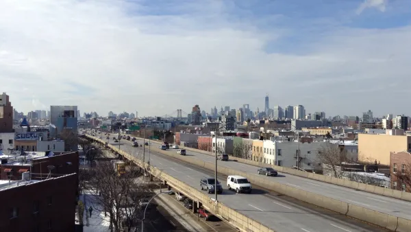
DOT’s plans aren’t entirely clear, Duggan writes. While “DOT’s conceptual renderings of a future highway do indeed show substantial new open spaces covering the roadways and sloping down to Brooklyn Bridge Park,” the renderings show a 40-foot-wide highway, which would only accommodate two lanes in each direction. Yet in a December statement, DOT said the agency anticipates that their analysis “will result in three lanes of traffic.”
An analysis conducted by Schwartz’s firm three years ago “found the roadway could work with just two lanes if officials tried to discourage driving by closing some ramps or limiting them to high-occupancy vehicles, or by charging to cross the East River bridges at the same rates as the tolled Hugh Carey Tunnel.” A spokesperson for the park says “park officials had been assured the repairs would not reduce green space.”
FULL STORY: Wider BQE Could Be ‘Intrusion’ on Brooklyn Bridge Park, Ex-Transportation Leaders Warn

Which Ambitious Renovation Plan for the BQE?
The Brooklyn-Queens Expressway needs work, but the various proposals have very different visions about how to tackle the project and what the final outcome will be.
Preventing Crime, One Park at a Time
Deborah Marton, executive director of the New York Restoration Project, connects parks and open space to improved public safety.
Fate of Brooklyn Heights Promenade Tethered to BQE Repair
The Brooklyn Heights Promenade will be closed as the Brooklyn-Queens Expressway below it is replaced. A Brownstoner column celebrates the esplanade's 68th birthday on Oct. 7, noting its troubled past and connection to Robert Moses.

National Parks Layoffs Will Cause Communities to Lose Billions
Thousands of essential park workers were laid off this week, just before the busy spring break season.

Retro-silient?: America’s First “Eco-burb,” The Woodlands Turns 50
A master-planned community north of Houston offers lessons on green infrastructure and resilient design, but falls short of its founder’s lofty affordability and walkability goals.

Delivering for America Plan Will Downgrade Mail Service in at Least 49.5 Percent of Zip Codes
Republican and Democrat lawmakers criticize the plan for its disproportionate negative impact on rural communities.

Test News Post 1
This is a summary

Test News Headline 46
Test for the image on the front page.

Balancing Bombs and Butterflies: How the National Guard Protects a Rare Species
The National Guard at Fort Indiantown Gap uses GIS technology and land management strategies to balance military training with conservation efforts, ensuring the survival of the rare eastern regal fritillary butterfly.
Urban Design for Planners 1: Software Tools
This six-course series explores essential urban design concepts using open source software and equips planners with the tools they need to participate fully in the urban design process.
Planning for Universal Design
Learn the tools for implementing Universal Design in planning regulations.
EMC Planning Group, Inc.
Planetizen
Planetizen
Mpact (formerly Rail~Volution)
Great Falls Development Authority, Inc.
HUDs Office of Policy Development and Research
NYU Wagner Graduate School of Public Service