


The century-old rule has shaped the District’s iconic horizontal skyline, but some Council members say it need revision in light of the region’s growing housing crisis.

The height limit that has long dominated the development of Washington, D.C.’s skyline is coming into question as District leaders seek to bring more housing units and residents to the central core as part of Mayor Bowser’s Comeback Plan. “A key goal of this plan is to ‘add 15,000 residents to the Downtown population by adding seven million square feet of residential units,’” writes Luke Garrett for WTOP.
The Height of Buildings Act, passed in 1910, limits building heights to 90 feet on residential streets and 130 feet on commercial corridors. Now, some District Council members are calling for changes to the century-old act as part of efforts to revitalize the city and adapt to changing housing and office space needs. “The District needs to address its affordable housing crisis through more density, so the Height Act should be on the table for negotiation as a way to increase density and housing units,” said Council member Zachary Parker.
Opponents of changing the Height Act say the District’s flat skyline is a “unique and defining characteristic.” Others call proposed changes to the Height Act a red herring, with Council member Brianne Nadeau saying that “We could double the amount of housing in the city right now if we updated the zoning code, even with the Height Act in place.”
FULL STORY: Why DC’s Height Act may fall this time

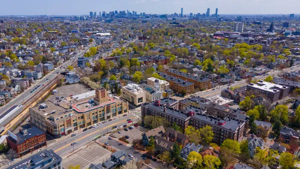
What Is Cambridge’s Affordable Housing Overlay?
A controversial policy is helping create more affordable housing units in the Massachusetts city, but fears of overwhelming density are likely unfounded.

Opinion: Failed Housing Bills Could Signal California-Style Housing Crisis in Texas
Legislators in a state that so often touts its policies as the opposite of California’s defeated several bills that would have made housing construction easier, leading to concerns that a constricted housing market may exacerbate the housing crisis.

How Houston Can Be a Model for Housing Reform
The city builds more new housing than almost any other and has dramatically reduced homelessness, yet low-income families struggle to find affordable housing.

National Parks Layoffs Will Cause Communities to Lose Billions
Thousands of essential park workers were laid off this week, just before the busy spring break season.

Retro-silient?: America’s First “Eco-burb,” The Woodlands Turns 50
A master-planned community north of Houston offers lessons on green infrastructure and resilient design, but falls short of its founder’s lofty affordability and walkability goals.

Delivering for America Plan Will Downgrade Mail Service in at Least 49.5 Percent of Zip Codes
Republican and Democrat lawmakers criticize the plan for its disproportionate negative impact on rural communities.

Test News Post 1
This is a summary

Test News Headline 46
Test for the image on the front page.

Balancing Bombs and Butterflies: How the National Guard Protects a Rare Species
The National Guard at Fort Indiantown Gap uses GIS technology and land management strategies to balance military training with conservation efforts, ensuring the survival of the rare eastern regal fritillary butterfly.
Urban Design for Planners 1: Software Tools
This six-course series explores essential urban design concepts using open source software and equips planners with the tools they need to participate fully in the urban design process.
Planning for Universal Design
Learn the tools for implementing Universal Design in planning regulations.
EMC Planning Group, Inc.
Planetizen
Planetizen
Mpact (formerly Rail~Volution)
Great Falls Development Authority, Inc.
HUDs Office of Policy Development and Research
NYU Wagner Graduate School of Public Service