


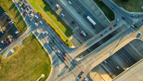
In addition to new HOV lanes and a proposed boardwalk, TxDOT agreed to engineer the freeway for caps in some areas, but the city would have to fund their construction.
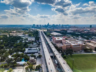
A letter sent by Austin mayor Kirk Watson to opponents of a freeway widening project outlines proposed changes to the Texas Department of Transportation (TxDOT)’s Interstate 35 expansion plan, which is being opposed by resident groups and some local officials.
According to an article by Nathan Bernier for KUT, “Adjustments to the once-in-a-generation project include the possibility of covering larger sections of the highway north of downtown, constructing a $25 million boardwalk on Lady Bird Lake and filtering stormwater runoff into the Colorado River.”
Bernier adds, “TxDOT's transformation plans include lowering the main lanes for much of the distance between Oltorf Street and Airport Boulevard. The City of Austin hopes to cover these lowered portions of the highway with "caps" — basically large decks — that could support buildings at least two stories tall. TxDOT won't pay for the caps, but will engineer the highway to allow for their installation.” The agency has agreed to lower a third portion to make way for a cap.
As part of the project, “TxDOT is set to construct a near half-billion-dollar drainage system, which includes a tunnel under Cesar Chavez Street that would direct stormwater runoff into the Colorado River near U.S. 183.” But according to the city’s Watershed Protection Department, “The current design would not have the capacity to treat all stormwater runoff.”
The article details other parts of the TxDOT plan, such as new high occupancy vehicle (HOV) lanes and the $25 million boardwalk along Lady Bird Lake that would replace other parkland that will be lost to the project. The expansion has faced staunch opposition from local residents, including three city council members, from the start.
FULL STORY: Austin's I-35 plans revised to include new cap and a $25 million boardwalk

Austin City Council Calls for Changes to Interstate Widening Plan
Legally powerless to stop TxDOT’s plans for freeway expansion, Austin city leaders hope to influence the agency to take some mitigation measures as it widens I-35.
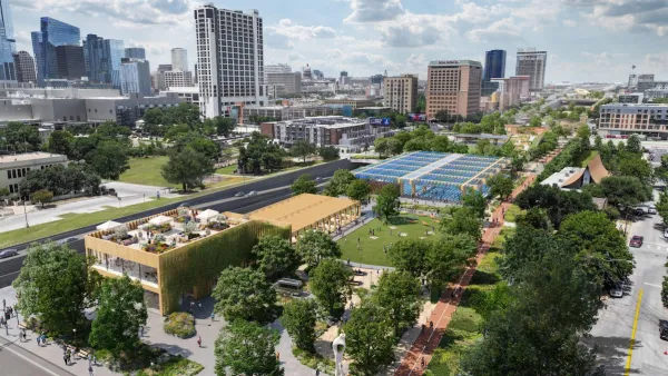
Austin’s Vision for I-35 Cap Parks Takes Final Shape
The city’s plan includes parks, entertainment pavilions, commercial space, sports fields, and other facilities over 30 acres of deck parks spanning a sunken Interstate 35.
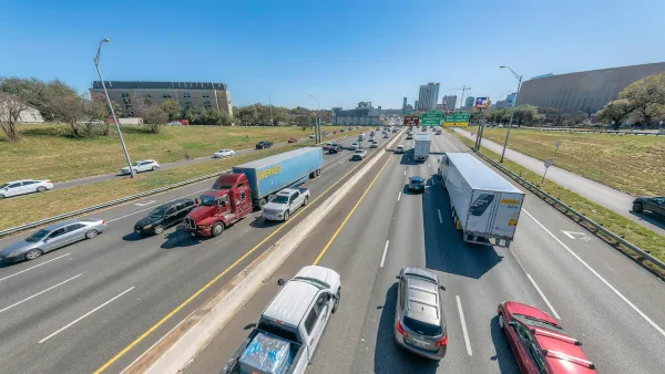
Austin Freeway Expansion Fight Continues
Opponents of the project have filed another lawsuit in hopes of halting the widening of Interstate 35.

National Parks Layoffs Will Cause Communities to Lose Billions
Thousands of essential park workers were laid off this week, just before the busy spring break season.

Retro-silient?: America’s First “Eco-burb,” The Woodlands Turns 50
A master-planned community north of Houston offers lessons on green infrastructure and resilient design, but falls short of its founder’s lofty affordability and walkability goals.

Delivering for America Plan Will Downgrade Mail Service in at Least 49.5 Percent of Zip Codes
Republican and Democrat lawmakers criticize the plan for its disproportionate negative impact on rural communities.

Test News Post 1
This is a summary

Test News Headline 46
Test for the image on the front page.

Balancing Bombs and Butterflies: How the National Guard Protects a Rare Species
The National Guard at Fort Indiantown Gap uses GIS technology and land management strategies to balance military training with conservation efforts, ensuring the survival of the rare eastern regal fritillary butterfly.
Urban Design for Planners 1: Software Tools
This six-course series explores essential urban design concepts using open source software and equips planners with the tools they need to participate fully in the urban design process.
Planning for Universal Design
Learn the tools for implementing Universal Design in planning regulations.
EMC Planning Group, Inc.
Planetizen
Planetizen
Mpact (formerly Rail~Volution)
Great Falls Development Authority, Inc.
HUDs Office of Policy Development and Research
NYU Wagner Graduate School of Public Service