


After the state broke ground on a tolled express lane project at the eastern edge of Kansas, near Kansas City, tolls are also under consideration in the nascent stages of a corridor study located at the southwest edge of the same region.
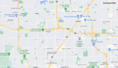
Options for investments along a 17.5-mile stretch of State Highway 10 where it runs through Johnson County, Kansas could include tolling.
Kaylie McLaughlin reports that consultants from HNTB are currently working on a corridor study for the state of Kansas—only the most recent study in a series of studies over the years, according to the article.
“Now, as traffic continues to increase and growth in the western part of the county booms, state and local leaders are looking at K-10 again, particularly the area between Cedar Creek Parkway in Olathe and where K-10 ends at I-435 in Lenexa,” writes McLaughlin. Poor repair and safety issues are also cited as a need for the investments along the corridor.
But tolls are the headlining topic of discussion in the study. “One solution discussed at length was the potential to add an express toll lane on K-10 through Johnson County, likely mostly in Lenexa, where traffic picks up closer to I-435,” reports McLaughlin.
According to McLaughlin, tolling is a relatively novel approach for the state of Kansas, but the state recently began work on express toll lanes along U.S. Highway 69 in Overland Park.
FULL STORY: Toll lane floated as way to ease K-10 congestion in JoCo

Maryland's Controversial Highway Widening Proposal Scaled Back
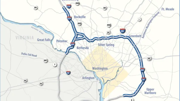
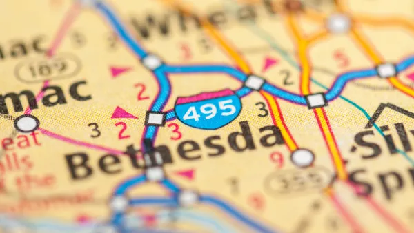
Interstate 270, the Capital Beltway, will no longer by widened as part of the I-495/I-270 Managed Lanes Project.
Maryland's Highway Expansion Project Out to Bid
Vocal opposition hasn't slowed the Maryland Department of Transportation's progress of the I-495/I-270 Managed Lanes Project.
Draft Environmental Impact Statement for Maryland's Big Highway Widening Project Released
The state of Maryland is moving forward with a highway widening plan that would spend $11 billion in a private-partnership to add toll lanes to two Capital Beltway highways.

National Parks Layoffs Will Cause Communities to Lose Billions
Thousands of essential park workers were laid off this week, just before the busy spring break season.

Retro-silient?: America’s First “Eco-burb,” The Woodlands Turns 50
A master-planned community north of Houston offers lessons on green infrastructure and resilient design, but falls short of its founder’s lofty affordability and walkability goals.

Delivering for America Plan Will Downgrade Mail Service in at Least 49.5 Percent of Zip Codes
Republican and Democrat lawmakers criticize the plan for its disproportionate negative impact on rural communities.

Test News Post 1
This is a summary

Test News Headline 46
Test for the image on the front page.

Balancing Bombs and Butterflies: How the National Guard Protects a Rare Species
The National Guard at Fort Indiantown Gap uses GIS technology and land management strategies to balance military training with conservation efforts, ensuring the survival of the rare eastern regal fritillary butterfly.
Urban Design for Planners 1: Software Tools
This six-course series explores essential urban design concepts using open source software and equips planners with the tools they need to participate fully in the urban design process.
Planning for Universal Design
Learn the tools for implementing Universal Design in planning regulations.
EMC Planning Group, Inc.
Planetizen
Planetizen
Mpact (formerly Rail~Volution)
Great Falls Development Authority, Inc.
HUDs Office of Policy Development and Research
NYU Wagner Graduate School of Public Service