


The heavy rain brought by a rare West Coast hurricane could have long-lasting impacts on this iconic American landscape.
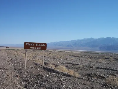
After Hurricane Hilary dropped two inches of rain in California’s Death Valley National Park, officials assessing the damage to park infrastructure and roads say it could be months before the park is fully accessible to visitors again—and the desert landscape could be changed forever. A majority of park roads remain closed, in many cases completely washed out by powerful torrents.
According to a Los Angeles Times article by Ryan Fonseca, “Officials told [L.A. Times reporter Hayley Smith] that some scorpions and lizards didn’t survive the flooding, but endangered pupfish appeared to make it through. Then there are the Bristlecone pines — some of the oldest known trees on Earth. The roadways up to the ancient forest are blocked by debris, so officials don’t yet know whether they survived the rain, wind and erosion.”
Now, officials will likely reinforce infrastructure as it gets rebuilt to prepare for future weather events that could become more intense due to climate change. “Climate models do seem to indicate that we will see more intense storms along with the higher temperatures,” said park ranger Matthew Lamar.
FULL STORY: How Hilary’s visit to Death Valley National Park reshaped the desert landscape


Auto Insurance Rates Spike Due to Extreme Weather
Car insurance costs around the country are going up as insurers receive more claims from areas struck by storms and other climate disasters.

Rising Insurance Rates Squeezing Affordable Housing Developers
Spiking insurance costs in coastal areas prone to climate disasters are making it harder for low-income housing developers to keep building.
Will Hurricanes Drive Away Florida’s Retirees?
Some children of Florida retirees are urging their parents to leave hurricane-prone areas for safer regions.

National Parks Layoffs Will Cause Communities to Lose Billions
Thousands of essential park workers were laid off this week, just before the busy spring break season.

Retro-silient?: America’s First “Eco-burb,” The Woodlands Turns 50
A master-planned community north of Houston offers lessons on green infrastructure and resilient design, but falls short of its founder’s lofty affordability and walkability goals.

Delivering for America Plan Will Downgrade Mail Service in at Least 49.5 Percent of Zip Codes
Republican and Democrat lawmakers criticize the plan for its disproportionate negative impact on rural communities.

Test News Post 1
This is a summary

Test News Headline 46
Test for the image on the front page.

Balancing Bombs and Butterflies: How the National Guard Protects a Rare Species
The National Guard at Fort Indiantown Gap uses GIS technology and land management strategies to balance military training with conservation efforts, ensuring the survival of the rare eastern regal fritillary butterfly.
Urban Design for Planners 1: Software Tools
This six-course series explores essential urban design concepts using open source software and equips planners with the tools they need to participate fully in the urban design process.
Planning for Universal Design
Learn the tools for implementing Universal Design in planning regulations.
EMC Planning Group, Inc.
Planetizen
Planetizen
Mpact (formerly Rail~Volution)
Great Falls Development Authority, Inc.
HUDs Office of Policy Development and Research
NYU Wagner Graduate School of Public Service