


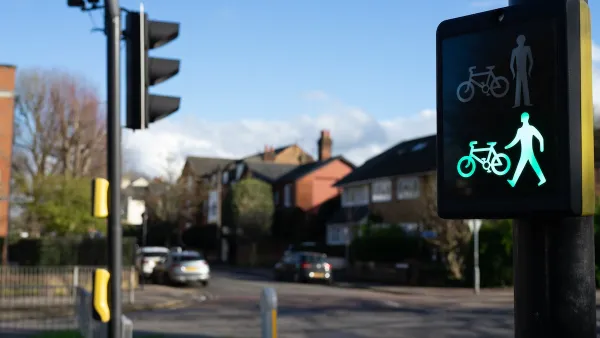
A recent study emphasizes the importance of good road design and low speed limits in keeping pedestrians safe.

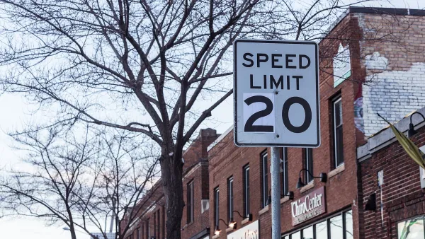
A new study of traffic deaths in Tennessee found a strong correlation between more pedestrian deaths and more crashes on “straight, multi-lane roads with speed limits over 35 miles per hour,” known as ‘stroads,’ that advocates say “combine the features of neighborhood streets with a car-oriented roads to deadly effect.” Kea Wilson describes the study in Streetsblog USA.
The study’s authors acknowledge that the size of vehicles can also be a factor in how deadly crashes are, “But the more important thing that we should be focusing on — and it's something that urban transportation professionals have a lot more control over — is speed on urban arterials.”
The study notes that Tennessee did not necessarily build more arterials during the time span that pedestrian deaths rose, but study author Christopher Cherry “suspects that a rising number of residents simply have no choice but to walk on the state's most-dangerous roads, particularly as incomes fall and poor residents who can't afford cars are pushed out of walkable downtowns and towards the sprawling fringe.” In other words, the suburbanization of poverty is putting more low-income people in harm’s way.
For Cherry, road design is a crucial key to improving safety. “We need to design roads where it’s almost impossible to kill someone.”
FULL STORY: Study: Yes, SUVs Are Deadlier Than Cars — But on Fast Arterials, Pedestrians Die No Matter What

‘Safe Land Use:’ A Key to Road Safety
How approaching transportation planning through a public health lens can reduce traffic deaths.

Jacksonville Takes Action on Vision Zero
The city is implementing its first-ever Vision Zero Action Plan in an effort to reduce pedestrian and cyclist deaths and serious injuries.
Chicago Could Join Other Cities in Lowering Speed Limits
Lowering speed limits by just 10 miles per hour can have a major impact on traffic safety.

National Parks Layoffs Will Cause Communities to Lose Billions
Thousands of essential park workers were laid off this week, just before the busy spring break season.

Retro-silient?: America’s First “Eco-burb,” The Woodlands Turns 50
A master-planned community north of Houston offers lessons on green infrastructure and resilient design, but falls short of its founder’s lofty affordability and walkability goals.

Delivering for America Plan Will Downgrade Mail Service in at Least 49.5 Percent of Zip Codes
Republican and Democrat lawmakers criticize the plan for its disproportionate negative impact on rural communities.

Test News Post 1
This is a summary

Test News Headline 46
Test for the image on the front page.

Balancing Bombs and Butterflies: How the National Guard Protects a Rare Species
The National Guard at Fort Indiantown Gap uses GIS technology and land management strategies to balance military training with conservation efforts, ensuring the survival of the rare eastern regal fritillary butterfly.
Urban Design for Planners 1: Software Tools
This six-course series explores essential urban design concepts using open source software and equips planners with the tools they need to participate fully in the urban design process.
Planning for Universal Design
Learn the tools for implementing Universal Design in planning regulations.
EMC Planning Group, Inc.
Planetizen
Planetizen
Mpact (formerly Rail~Volution)
Great Falls Development Authority, Inc.
HUDs Office of Policy Development and Research
NYU Wagner Graduate School of Public Service