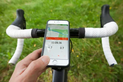
Strava just announced the ten-year anniversary of Metro, a proprietary web platform that provides data insights to partner organizations to make active transportation better for cyclists and pedestrians.

The mobile app Strava, which incorporates social networking features, is a popular tool for tracking physical activity. Starting out tracking mostly outdoor cycling and running activities using Global Positioning System data, Strava now incorporates various other exercise types including indoor activities. Strava just announced the ten-year anniversary of Metro, the web platform that provides data insights to make active transportation better for cyclists and pedestrians. With Metro, Strava's goal is to power smarter and more sustainable infrastructure globally and to give back to the communities that support millions of users around the world.
Created in 2013, Metro provides de-identified, aggregated bicycle and pedestrian trip insights to planners, advocacy groups, researchers, and other interested parties. Active community members who have opted-in and track their trips on Strava are anonymously feeding into the Metro dataset and in turn, helping planners and transportation experts in their communities to understand mobility patterns, identify opportunities for investment, and evaluate the impact of infrastructure changes, giving more opportunity through improved transportation access.
Examples of organizations that have successfully applied Strava Metro data include the Atlanta Department of Transportation, Los Angeles County Department of Parks and Recreation, the city of Paris, and the government of Catalonia. Globally, users have uploaded more than eight billion activities to Strava and nearly five billion miles traveled by walking or cycling. When the community contributes their activities to Metro, they become a critical part of one of the world’s largest collections of mobility data.
FULL STORY: Strava’s Metro Reaches Significant Milestone of 10 Year Anniversary

National Parks Layoffs Will Cause Communities to Lose Billions
Thousands of essential park workers were laid off this week, just before the busy spring break season.

Retro-silient?: America’s First “Eco-burb,” The Woodlands Turns 50
A master-planned community north of Houston offers lessons on green infrastructure and resilient design, but falls short of its founder’s lofty affordability and walkability goals.

Delivering for America Plan Will Downgrade Mail Service in at Least 49.5 Percent of Zip Codes
Republican and Democrat lawmakers criticize the plan for its disproportionate negative impact on rural communities.

Test News Post 1
This is a summary

Test News Headline 46
Test for the image on the front page.

Balancing Bombs and Butterflies: How the National Guard Protects a Rare Species
The National Guard at Fort Indiantown Gap uses GIS technology and land management strategies to balance military training with conservation efforts, ensuring the survival of the rare eastern regal fritillary butterfly.
Urban Design for Planners 1: Software Tools
This six-course series explores essential urban design concepts using open source software and equips planners with the tools they need to participate fully in the urban design process.
Planning for Universal Design
Learn the tools for implementing Universal Design in planning regulations.
EMC Planning Group, Inc.
Planetizen
Planetizen
Mpact (formerly Rail~Volution)
Great Falls Development Authority, Inc.
HUDs Office of Policy Development and Research
NYU Wagner Graduate School of Public Service


