


The rise in conversions of office buildings to housing and other uses raises questions about curb management and parking.

As the movement to convert office buildings to housing gains steam, new questions are arising about how to adapt the curb space and parking around converted buildings. “Cities need to consider how vehicle storage, bike and bus lanes, and drop-off zones in front of buildings need to change with building conversions, Transportation for America Policy Director Benito O. Pérez said.”
Amanda Loudin explains in Smart Cities Dive, using an example from Chicago, where planners and developers are working to understand how office conversions affect parking, mobility, and transit needs. For example, “Loading docks, useful for office buildings, are not a good fit for residents awaiting deliveries from Amazon.”
Toccarra Nicole Thomas, director of land use and development at Smart Growth America, says “You have to prioritize people movement and activities.” According to Thomas, “That means considering modes and access to buildings, like bike lanes and bus lanes, congestion, and being open to experimentation.”
FULL STORY: Office-to-residential conversions raise questions at the curb


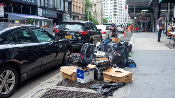
Reimagining the Curb: How Smart Curb Management is Transforming Urban Mobility
Modern demands for curbside space call for new ways to manage and allocate it.

Office Conversion Sees No Sign of Slowing
The adaptive reuse of office buildings for residential and other uses will grow by as much as 63 percent in 2024 over last year.
NYC Launches ‘Smart Curbs’ Program
The pilot program on the Upper West Side will remove some curbside parking spots to replace them with public seating, bike racks, and delivery zones.

National Parks Layoffs Will Cause Communities to Lose Billions
Thousands of essential park workers were laid off this week, just before the busy spring break season.

Retro-silient?: America’s First “Eco-burb,” The Woodlands Turns 50
A master-planned community north of Houston offers lessons on green infrastructure and resilient design, but falls short of its founder’s lofty affordability and walkability goals.

Delivering for America Plan Will Downgrade Mail Service in at Least 49.5 Percent of Zip Codes
Republican and Democrat lawmakers criticize the plan for its disproportionate negative impact on rural communities.

Test News Post 1
This is a summary

Test News Headline 46
Test for the image on the front page.

Balancing Bombs and Butterflies: How the National Guard Protects a Rare Species
The National Guard at Fort Indiantown Gap uses GIS technology and land management strategies to balance military training with conservation efforts, ensuring the survival of the rare eastern regal fritillary butterfly.
Urban Design for Planners 1: Software Tools
This six-course series explores essential urban design concepts using open source software and equips planners with the tools they need to participate fully in the urban design process.
Planning for Universal Design
Learn the tools for implementing Universal Design in planning regulations.
EMC Planning Group, Inc.
Planetizen
Planetizen
Mpact (formerly Rail~Volution)
Great Falls Development Authority, Inc.
HUDs Office of Policy Development and Research
NYU Wagner Graduate School of Public Service