


The proposed Dorchester Greenway would create a new linear park above part of the Red Line subway.
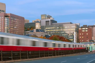
A proposed greenway would cap a 0.75-mile subterranean segment of Boston’s Red Line subway with a linear park, reports Daniel Roche in The Architect’s Newspaper. “With $300,000 in funding from the MassTrails program, a state initiative, and an additional $368,000 from the city of Boston; officials, community leaders, and designers are gearing up to build a new pathway for walkers and bikers, dubbed The Dorchester Greenway.”
According to Roche, “Today, the stretch between Fields Corner Station and Ashmont Station is below grade, topped by a derelict asphalt carpet. For years, community activists have sought to build a park on the land currently owned by the Massachusetts Bay Transportation Authority (MBTA).” Local advocates say the greenway would provide new public green space and stitch the neighborhood back together. Cap parks are becoming an increasingly popular way to utilize space above active or defunct freeways or subway lines, although some projects, like one in Denver, have triggered gentrification and displacement concerns.
FULL STORY: The Dorchester Greenway, a speculative linear park, may soon be built in Boston over the Red Line

I Help Plan Cap Parks; Here’s What Austin Can Learn from Other Cities
How freeway capping projects can literally and metaphorically bridge urban divides.
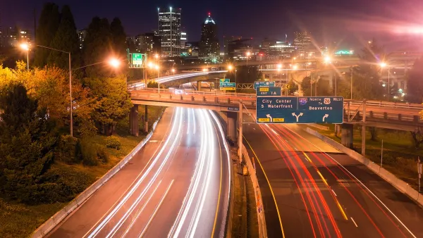
USDOT Denies Portland Freeway Expansion Grant
The agency declined the Oregon Department of Transportation’s request for $750 million to fund the I-5 Rose Quarter Improvement Project.
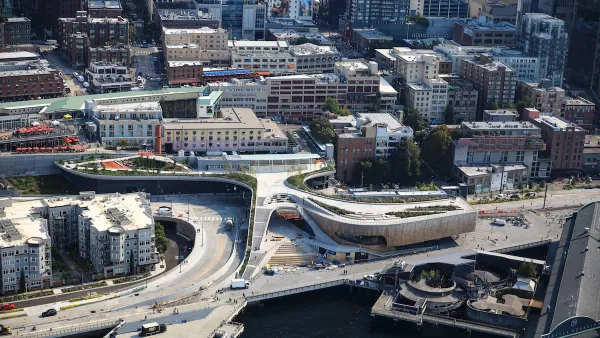
Seattle’s New Overlook Walk Offers Ample Park Space Near Pike Place Market
The elevated park and event space replaces part of the demolished Alaskan Way Viaduct, connecting the city’s famous Pike Place Market to the waterfront.

National Parks Layoffs Will Cause Communities to Lose Billions
Thousands of essential park workers were laid off this week, just before the busy spring break season.

Retro-silient?: America’s First “Eco-burb,” The Woodlands Turns 50
A master-planned community north of Houston offers lessons on green infrastructure and resilient design, but falls short of its founder’s lofty affordability and walkability goals.

Delivering for America Plan Will Downgrade Mail Service in at Least 49.5 Percent of Zip Codes
Republican and Democrat lawmakers criticize the plan for its disproportionate negative impact on rural communities.

Test News Post 1
This is a summary

Test News Headline 46
Test for the image on the front page.

Balancing Bombs and Butterflies: How the National Guard Protects a Rare Species
The National Guard at Fort Indiantown Gap uses GIS technology and land management strategies to balance military training with conservation efforts, ensuring the survival of the rare eastern regal fritillary butterfly.
Urban Design for Planners 1: Software Tools
This six-course series explores essential urban design concepts using open source software and equips planners with the tools they need to participate fully in the urban design process.
Planning for Universal Design
Learn the tools for implementing Universal Design in planning regulations.
EMC Planning Group, Inc.
Planetizen
Planetizen
Mpact (formerly Rail~Volution)
Great Falls Development Authority, Inc.
HUDs Office of Policy Development and Research
NYU Wagner Graduate School of Public Service