


According to a report released by the agency, NYCDOT failed to meet its benchmarks for installing new dedicated bus and bike lanes.
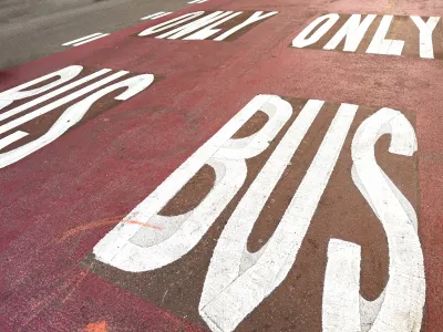
The New York City Department of Transportation quietly released its status report on the city’s Streets Plan, which calls for building 80 miles of protected bike lanes and 50 miles of dedicated bus lanes in the first two years of Eric Adams’ term as mayor, reports Gersh Kuntzman in Streetsblog NYC.
According to the report, the agency only built 58.2 miles of bike lanes and 9.6 miles of bus lanes, failing its goals by a wide margin. “The agency was also required to upgrade 1,000 bus stops, but has done 68, or 6.8 percent. Even including 320 bus stops that got seating, that only brings the percentage up to 39 percent,” Kuntzman adds.
The agency did meet the requirements for new accessible signals and new pedestrian space, claiming that it added 1,083,725 square feet of new public space.
Kuntzman notes that “The DOT's failure will likely be of minor concern to Mayor Adams, who emphasized last year that he would not be bound by the legal benchmarks of the Streets Plan, and created an entirely new office inside City Hall to oversee and stall DOT projects.”
FULL STORY: DOT Spins Bus- and Bike-Lane Failure as ‘Streets Plan’ Success


NYC Streets Plan Remains Largely on Paper
For the second year in a row, the city failed to meet legally required targets for building protected bike lanes and bus lanes.

Third Avenue Redesign Plan Revealed
The plan to reimagine Manhattan’s Third Avenue to make it safer for pedestrians and cyclists is being applauded by advocates, but some say the city should go further to provide more space for multimodal transportation.

A Troubling Trend of Backlash to Bike Lanes
Some cities are going so far as to rip out protected bike infrastructure that took years of advocacy to build.

National Parks Layoffs Will Cause Communities to Lose Billions
Thousands of essential park workers were laid off this week, just before the busy spring break season.

Retro-silient?: America’s First “Eco-burb,” The Woodlands Turns 50
A master-planned community north of Houston offers lessons on green infrastructure and resilient design, but falls short of its founder’s lofty affordability and walkability goals.

Delivering for America Plan Will Downgrade Mail Service in at Least 49.5 Percent of Zip Codes
Republican and Democrat lawmakers criticize the plan for its disproportionate negative impact on rural communities.

Test News Post 1
This is a summary

Test News Headline 46
Test for the image on the front page.

Balancing Bombs and Butterflies: How the National Guard Protects a Rare Species
The National Guard at Fort Indiantown Gap uses GIS technology and land management strategies to balance military training with conservation efforts, ensuring the survival of the rare eastern regal fritillary butterfly.
Urban Design for Planners 1: Software Tools
This six-course series explores essential urban design concepts using open source software and equips planners with the tools they need to participate fully in the urban design process.
Planning for Universal Design
Learn the tools for implementing Universal Design in planning regulations.
EMC Planning Group, Inc.
Planetizen
Planetizen
Mpact (formerly Rail~Volution)
Great Falls Development Authority, Inc.
HUDs Office of Policy Development and Research
NYU Wagner Graduate School of Public Service