


Pedestrian deaths rose last year, but remain below pre-2020 levels.
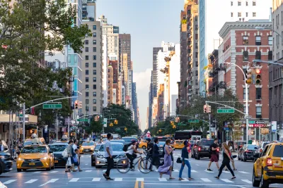
In an article for PIX 11, Emily Rahhal highlights the New York City neighborhoods listed as most dangerous to people on foot by the NYC Crash Mapper.
Borough Park takes the dubious top honor, with six deadly crashes in 2023. “The Upper West Side, East Harlem, Williamsburg, Flushing, Ozone Park, and Woodside, were the next deadliest neighborhoods for pedestrians, each with three fatalities in 2023. Many neighborhoods, like Harlem, Hell’s Kitchen and Soho, had none.” Among the boroughs, Queens had the most pedestrian deaths at 31.
The long-term trends are more encouraging. “Since 2013, pedestrian deaths have dropped by over 40% across New York City, according to the Department of Transportation. Overall, traffic deaths have decreased by over 12%, according to the DOT.”
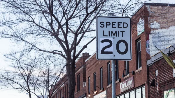
New York City recently won the right to set its own speed limits, paving the way for lower speed limits that traffic safety advocates say are shown to reduce pedestrian fatalities and injuries thanks to a law dubbed Sammy’s Law, which Governor Hochul included in the FY2025 state budget last week.
FULL STORY: What are NYC’s deadliest neighborhoods for pedestrians?

Chicago Could Join Other Cities in Lowering Speed Limits
Lowering speed limits by just 10 miles per hour can have a major impact on traffic safety.
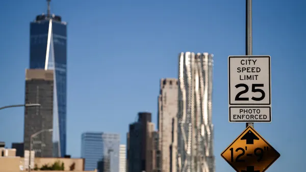
NYC Legislators Continue Fight to Set Own Speed Limits
Advocates say lower speed limits save lives and prevent fatal crashes on busy city streets.

OKC Releases Draft Vision Zero Plan
The plan identifies a High Injury Network and strategies for improving road safety on Oklahoma City streets.

National Parks Layoffs Will Cause Communities to Lose Billions
Thousands of essential park workers were laid off this week, just before the busy spring break season.

Retro-silient?: America’s First “Eco-burb,” The Woodlands Turns 50
A master-planned community north of Houston offers lessons on green infrastructure and resilient design, but falls short of its founder’s lofty affordability and walkability goals.

Delivering for America Plan Will Downgrade Mail Service in at Least 49.5 Percent of Zip Codes
Republican and Democrat lawmakers criticize the plan for its disproportionate negative impact on rural communities.

Test News Post 1
This is a summary

Test News Headline 46
Test for the image on the front page.

Balancing Bombs and Butterflies: How the National Guard Protects a Rare Species
The National Guard at Fort Indiantown Gap uses GIS technology and land management strategies to balance military training with conservation efforts, ensuring the survival of the rare eastern regal fritillary butterfly.
Urban Design for Planners 1: Software Tools
This six-course series explores essential urban design concepts using open source software and equips planners with the tools they need to participate fully in the urban design process.
Planning for Universal Design
Learn the tools for implementing Universal Design in planning regulations.
EMC Planning Group, Inc.
Planetizen
Planetizen
Mpact (formerly Rail~Volution)
Great Falls Development Authority, Inc.
HUDs Office of Policy Development and Research
NYU Wagner Graduate School of Public Service