


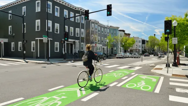
State and local officials are zeroing in on some of the region’s most dangerous streets and transit corridors.

Safety improvements are coming to a major street in Oakland, California, reports Kristin J. Bender in The Mercury News, after 18 or more pedestrians were killed on International Boulevard in the last two years. “Improvements are being funded by a $400,000 grant from the Metropolitan Transportation Commission and $1.8 million from the city of Oakland, officials said.”
The project joins other efforts to make Bay Area streets safer and more connected for pedestrians, transit users, and cyclists. In San Mateo County, the local transportation authority plans to improve sidewalk crossings and bike and pedestrian routes that connect to Caltrain, BART, and other public transit. “That could include building pathways over or under the elevated Caltrain tracks and adjacent Highway 101 corridor to better connect the downtown area to the city’s job center and biotech hub in its former industrial core to the east.”
Bender notes that “last week, the Regional Network Management Council, a coalition of Bay Area transit agencies, earmarked more than $18 million for eight projects under the Bus Accelerated Infrastructure Delivery program, commonly known as ‘BusAID.’” The program is designed to improve bus speed and reliability and make key transit corridors safer for all users.
FULL STORY: Deadly Bay Area streets spark officials to make traffic safety improvements


Jacksonville Takes Action on Vision Zero
The city is implementing its first-ever Vision Zero Action Plan in an effort to reduce pedestrian and cyclist deaths and serious injuries.
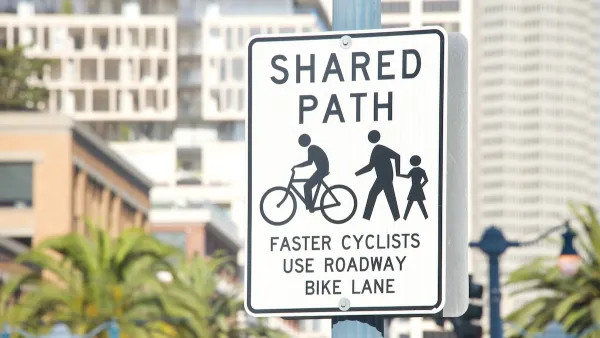
NACTO Releases Updated Urban Bikeway Guide
The third edition of the nationally recognized road design guide includes detailed design advice for roads that prioritize safety and accessibility for all users.
California Adds Complete Streets to Transportation Funding Guidelines
The state transportation commission previously declined to include bike and pedestrian infrastructure in its updated funding guidelines, despite a new state law requiring Complete Streets efforts in all Caltrans projects.

National Parks Layoffs Will Cause Communities to Lose Billions
Thousands of essential park workers were laid off this week, just before the busy spring break season.

Retro-silient?: America’s First “Eco-burb,” The Woodlands Turns 50
A master-planned community north of Houston offers lessons on green infrastructure and resilient design, but falls short of its founder’s lofty affordability and walkability goals.

Delivering for America Plan Will Downgrade Mail Service in at Least 49.5 Percent of Zip Codes
Republican and Democrat lawmakers criticize the plan for its disproportionate negative impact on rural communities.

Test News Post 1
This is a summary

Test News Headline 46
Test for the image on the front page.

Balancing Bombs and Butterflies: How the National Guard Protects a Rare Species
The National Guard at Fort Indiantown Gap uses GIS technology and land management strategies to balance military training with conservation efforts, ensuring the survival of the rare eastern regal fritillary butterfly.
Urban Design for Planners 1: Software Tools
This six-course series explores essential urban design concepts using open source software and equips planners with the tools they need to participate fully in the urban design process.
Planning for Universal Design
Learn the tools for implementing Universal Design in planning regulations.
EMC Planning Group, Inc.
Planetizen
Planetizen
Mpact (formerly Rail~Volution)
Great Falls Development Authority, Inc.
HUDs Office of Policy Development and Research
NYU Wagner Graduate School of Public Service