


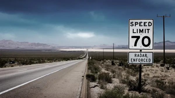
Interstate speed limits can have an impact beyond their own lanes.

A new study reveals that increased speed limits on interstate freeways have a rippling effect, raising the number of speeding-related crashes in adjacent neighborhoods.
As Kea Wilson explains in Streetsblog USA, “In an analysis of three U.S. highway segments whose maximum speeds were increased at some point in the last decade — I-85 in Georgia, I-84 in Oregon and I-75 and I-69 in Michigan — researchers found that all reported significant new "clusters" of speeding-related crashes within a one-mile radius of the interstate.”
The findings belie the popular belief that interstate speeds don’t affect people traveling on other roads — including pedestrians and cyclists who never enter freeways. According to Dr. C.Y. David Yang, president and executive director of the AAA Foundation for Traffic Safety, “similarly to the ‘distraction hangover’ that drivers experience even after they stop using a cell phone behind the wheel, motorists don't immediately register just how quickly they need to slow down after they exit the interstate — especially when local roads themselves are designed like highways where it's perfectly fine to go fast.”
Wilson points out that interstate routes and speed limits are controlled at the state level, giving local communities little say in the process. “While Yang stops short of saying that speed limits should never be raised on the highway, he says it's critical that stakeholders like state, county, and city departments of transportation communicate in advance of those increases, so the locals can take action to slow drivers down, like modifying road designs.”
FULL STORY: Study: When Speed Limits Rise on Interstates, So Do Crash Hot Spots on Nearby Roads

California Bill Would Require Speed Governors on Cars
The legislation would call for speed-limiting technology on cars made and sold in the state that would keep speeds to no more than 10 miles over the posted speed limit.
Has Progress on Travel Safety Run Off the Road?
Changing technology and rebuilding infrastructure to improve road safety are long-term strategies. How can enforcement and interventions that influence driver behavior make a difference in reducing traffic deaths sooner?
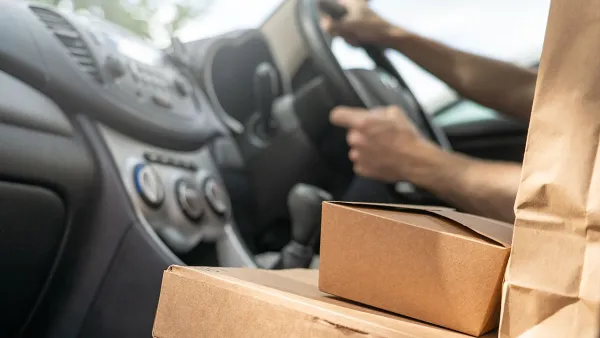
Boston Ordinance Would Regulate Delivery Drivers
A proposed law would require delivery companies to acquire insurance, permits, and submit monthly reports to the city.

National Parks Layoffs Will Cause Communities to Lose Billions
Thousands of essential park workers were laid off this week, just before the busy spring break season.

Retro-silient?: America’s First “Eco-burb,” The Woodlands Turns 50
A master-planned community north of Houston offers lessons on green infrastructure and resilient design, but falls short of its founder’s lofty affordability and walkability goals.

Delivering for America Plan Will Downgrade Mail Service in at Least 49.5 Percent of Zip Codes
Republican and Democrat lawmakers criticize the plan for its disproportionate negative impact on rural communities.

Test News Post 1
This is a summary

Test News Headline 46
Test for the image on the front page.

Balancing Bombs and Butterflies: How the National Guard Protects a Rare Species
The National Guard at Fort Indiantown Gap uses GIS technology and land management strategies to balance military training with conservation efforts, ensuring the survival of the rare eastern regal fritillary butterfly.
Urban Design for Planners 1: Software Tools
This six-course series explores essential urban design concepts using open source software and equips planners with the tools they need to participate fully in the urban design process.
Planning for Universal Design
Learn the tools for implementing Universal Design in planning regulations.
EMC Planning Group, Inc.
Planetizen
Planetizen
Mpact (formerly Rail~Volution)
Great Falls Development Authority, Inc.
HUDs Office of Policy Development and Research
NYU Wagner Graduate School of Public Service