


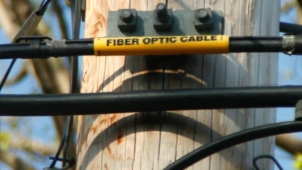
The Arizona Department of Transportation announced a public-private partnership to install fiber-optic infrastructure along 405 miles of interstate highways to enable vehicle connectivity.
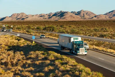
A new project announced in April will lay the groundwork for connected and automated vehicles in Arizona, according to a Gov Tech article by Skip Descant. “The project, a partnership among the Arizona Department of Transportation (ADOT), the Arizona Commerce Authority and eX2 Technology…will lay 405 miles of fiber along interstates 40, 19 and 17,” Descant reports.
The project, which is expected to begin later this year, will serve dual purposes: a ‘testbed” for intelligent transportation systems technology and “middle-mile” broadband “intended to build out the infrastructure needed to support final ‘last-mile’ connections to homes and businesses,” particularly those in rural areas and on tribal lands. In addition to connected and automated vehicles, an ADOT representative told Gov Tech the new fiber infrastructure will support overhead message boards, traffic cameras, weather stations, and wrong-way driving detection.
“The project is seen as a significant advancement of the national goal to bring broadband to unserved and underserved areas. Arizona received more than $993.1 million from the Broadband Equity Access and Deployment (BEAD) Program, part of the 2021 federal Infrastructure Investment and Jobs Act,” writes Descant.
FULL STORY: Arizona Fiber Work Will Connect Vehicles and Residents

The 'Worst-Connected Cities' in the United States
Here are the cities where residents are the least likely to have a broadband Internet connection in their home.
Mapping the Gap Between Broadband Access and Broadband Subscription
Not everyone that has access to high-quality Internet infrastructure is making use of it.
San Antonians Angry About Huts, Google Fiber's Fast Internet Plan Hits a Speedbump
Some in Texas are worried about the structures that house Google's Fiberoptic Cables, complaining that the huts are ugly and take up too much park space.

National Parks Layoffs Will Cause Communities to Lose Billions
Thousands of essential park workers were laid off this week, just before the busy spring break season.

Retro-silient?: America’s First “Eco-burb,” The Woodlands Turns 50
A master-planned community north of Houston offers lessons on green infrastructure and resilient design, but falls short of its founder’s lofty affordability and walkability goals.

Delivering for America Plan Will Downgrade Mail Service in at Least 49.5 Percent of Zip Codes
Republican and Democrat lawmakers criticize the plan for its disproportionate negative impact on rural communities.

Test News Post 1
This is a summary

Test News Headline 46
Test for the image on the front page.

Balancing Bombs and Butterflies: How the National Guard Protects a Rare Species
The National Guard at Fort Indiantown Gap uses GIS technology and land management strategies to balance military training with conservation efforts, ensuring the survival of the rare eastern regal fritillary butterfly.
Urban Design for Planners 1: Software Tools
This six-course series explores essential urban design concepts using open source software and equips planners with the tools they need to participate fully in the urban design process.
Planning for Universal Design
Learn the tools for implementing Universal Design in planning regulations.
EMC Planning Group, Inc.
Planetizen
Planetizen
Mpact (formerly Rail~Volution)
Great Falls Development Authority, Inc.
HUDs Office of Policy Development and Research
NYU Wagner Graduate School of Public Service