


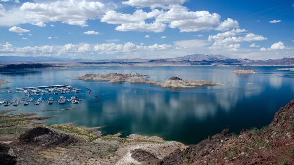
As visitors seek out ways to reach the lake’s increasingly distant shoreline, officials say illegally created roads are damaging environmental and cultural resources and leading to hundreds of calls for rescue for stranded vehicles.
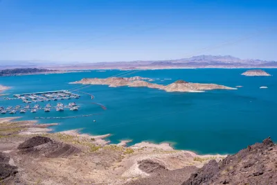
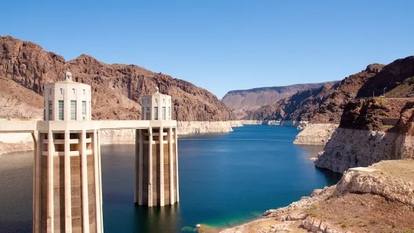
As water levels in Lake Mead and other western reservoirs reach perilous lows, people desperate to access the lake’s shores are creating a growing network of illegal roads that threaten the environment in Lake Mead National Recreation Area. “The park service has documented 824 miles of illegal roads, although the agency estimates two to three times that many exist.”
As Amy Alonzo explains in an article for the Nevada Independent, “When water levels were higher, an official road reached the lakeshore roughly every 10 miles, providing approximately 60 access points for visitors.” Now, only 10 approved roads exist, with half of them concentrated at one beach, making access to most of the lake’s shores “virtually nonexistent.”
Now, “Visitors have thus taken it upon themselves to create new roadways, including driving between official roads in attempts to reach isolated points along the water.” Park officials say vehicles on these roads destroy environmental and cultural resources and often require assistance after getting stuck — with few ways to describe to rescuers where they are.
The National Park Service (NPS) is requesting $8.67 million in federal funding to address the illegal roads by creating specific management plans, defining where backcountry camping is allowed, and boosting enforcement. “Park officials are also considering implementing a permitting system for camping — either free or paid — and putting location boundaries on backcountry use.”
FULL STORY: Lake Mead’s illegal road network is growing

Western States Face New Round of Water Cuts
In Nevada, efforts to conserve water include a ban on ornamental grass and regulations on swimming pool sizes.
Colorado River States Inch Closer to Agreement
Upper Basin and Lower Basin states each say their plan for conserving the Colorado River’s water is the most sustainable.
The Year in Public Lands
Public policy decisions that will impact land and water conservation in the American West.

National Parks Layoffs Will Cause Communities to Lose Billions
Thousands of essential park workers were laid off this week, just before the busy spring break season.

Retro-silient?: America’s First “Eco-burb,” The Woodlands Turns 50
A master-planned community north of Houston offers lessons on green infrastructure and resilient design, but falls short of its founder’s lofty affordability and walkability goals.

Delivering for America Plan Will Downgrade Mail Service in at Least 49.5 Percent of Zip Codes
Republican and Democrat lawmakers criticize the plan for its disproportionate negative impact on rural communities.

Test News Post 1
This is a summary

Test News Headline 46
Test for the image on the front page.

Balancing Bombs and Butterflies: How the National Guard Protects a Rare Species
The National Guard at Fort Indiantown Gap uses GIS technology and land management strategies to balance military training with conservation efforts, ensuring the survival of the rare eastern regal fritillary butterfly.
Urban Design for Planners 1: Software Tools
This six-course series explores essential urban design concepts using open source software and equips planners with the tools they need to participate fully in the urban design process.
Planning for Universal Design
Learn the tools for implementing Universal Design in planning regulations.
EMC Planning Group, Inc.
Planetizen
Planetizen
Mpact (formerly Rail~Volution)
Great Falls Development Authority, Inc.
HUDs Office of Policy Development and Research
NYU Wagner Graduate School of Public Service