


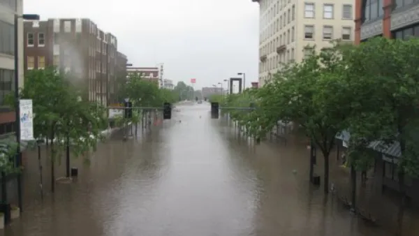
Lack of gray and green infrastructure in the city’s densest communities, particularly in historically Black Southeast D.C., has led to higher amounts of flooding in those neighborhoods.

“A new University of Maryland study suggests that Washington, D.C.'s most socioeconomically vulnerable neighborhoods are less equipped to handle runoff from heavy rainfalls made more frequent by climate change,” according to a recent article by Maggie Haslam for Phys.org.
The study found that the city’s densest communities, particularly those in historically Black Southeast D.C., have fewer sewer pipes and lack green and gray infrastructure like permeable pavement, rain gardens, trees, and green roofs to adequately control and absorb the stormwater.
The higher prevalence of impervious surfaces in these neighborhoods creates excess runoff, which then overwhelms the outdated sewer structure, resulting in more frequent and severe flooding. Researchers attribute the disinvestment and infrastructure inequity to “racist planning practices dating to the 19th century that fueled inequitable infrastructure distribution and housing conditions across D.C.”
“The study … is one of the few to look at both above- and below-ground infrastructure through a socioeconomic lens, and the first to do so for the District of Columbia, with the aim of helping city planners funnel infrastructure dollars to neighborhoods most at risk,” Haslam reports.
FULL STORY: Stormwater hits D.C.'s poorest neighborhoods hardest, study finds


How US Communities Are Building Resilience Against Flooding
Flooding causes over $400 billion in damage in the United States every year.
A Toolbox of Green Infrastructure Solutions to Flooding Risks
A new one-stop shop for green infrastructure solutions is available to planners and engineers challenged by flooding.
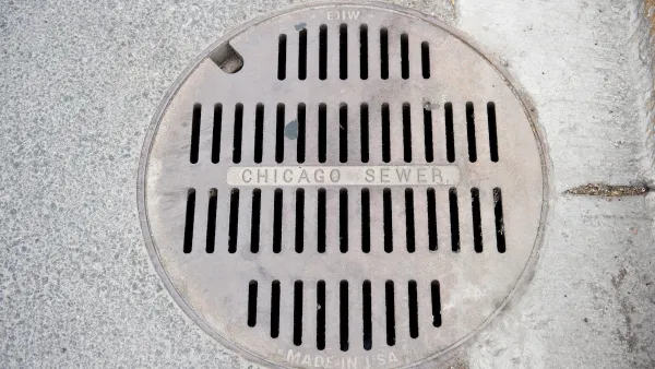
Chicago to Update Stormwater Plan
Chicago is one of 700 U.S. cities with combined sewer and stormwater systems that often lead to flooding during major rain events.

National Parks Layoffs Will Cause Communities to Lose Billions
Thousands of essential park workers were laid off this week, just before the busy spring break season.

Retro-silient?: America’s First “Eco-burb,” The Woodlands Turns 50
A master-planned community north of Houston offers lessons on green infrastructure and resilient design, but falls short of its founder’s lofty affordability and walkability goals.

Delivering for America Plan Will Downgrade Mail Service in at Least 49.5 Percent of Zip Codes
Republican and Democrat lawmakers criticize the plan for its disproportionate negative impact on rural communities.

Test News Post 1
This is a summary

Test News Headline 46
Test for the image on the front page.

Balancing Bombs and Butterflies: How the National Guard Protects a Rare Species
The National Guard at Fort Indiantown Gap uses GIS technology and land management strategies to balance military training with conservation efforts, ensuring the survival of the rare eastern regal fritillary butterfly.
Urban Design for Planners 1: Software Tools
This six-course series explores essential urban design concepts using open source software and equips planners with the tools they need to participate fully in the urban design process.
Planning for Universal Design
Learn the tools for implementing Universal Design in planning regulations.
EMC Planning Group, Inc.
Planetizen
Planetizen
Mpact (formerly Rail~Volution)
Great Falls Development Authority, Inc.
HUDs Office of Policy Development and Research
NYU Wagner Graduate School of Public Service