


The City Nature Challenge invites people worldwide to document urban biodiversity by photographing and sharing wild plants and animals through the iNaturalist app, helping scientists track and understand real-time changes in ecosystems.
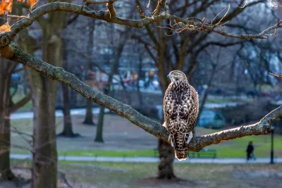
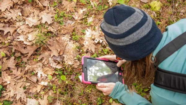
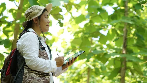
The City Nature Challenge is a global event happening from April 25 to April 28, 2025, inviting individuals of all ages and backgrounds to explore and document the wild plants, animals, and fungi in their surroundings. This initiative aims to engage community scientists, nature enthusiasts, and everyday observers to contribute to tracking real-time biodiversity changes. By sharing photographs of wildlife, participants help scientists better understand the planet’s ecosystems and advance wildlife conservation efforts.
Participation is simple and starts at home. Observers can explore their homes, backyards, or neighborhoods to find wild plants, insects, or animals—whether it is a bird on a powerline, a weed sprouting in the yard, or an insect scurrying under leaves. Local parks also provide excellent opportunities to discover different species by checking grass, plants, benches, and trees. Safety is paramount, so participants are encouraged to be mindful of their surroundings when exploring and documenting wildlife.
To join, download the iNaturalist app and follow four easy steps: locate wildlife in your area, take photos of wild plants and animals, share your findings through the app, and engage with the community as your observations are identified. Remember to mark anything planted or cared for by people as “captive” or “cultivated” to ensure accurate data. By participating in the City Nature Challenge, you will not only contribute to global biodiversity research but also gain a deeper appreciation for the natural world around you.
FULL STORY: 2025 City Nature Challenge

Detecting Invasive Species Early Through Citizen Science
Community science platforms like eBird and iNaturalist enhance early detection of invasive species, complementing professional surveillance and highlighting the need for stronger collaboration between the public and official authorities.
Discovering LA’s Biodiversity: The 2024 BioBlitz Challenge
The BioBlitz Challenge invites participants to document local wildlife throughout October using the iNaturalist app, contributing to conservation efforts and scientific research on Los Angeles' biodiversity.

Using Sound to Revive Ecosystems and Enhance Biodiversity
This innovative approach leverages the power of sound to stimulate beneficial soil microbes, offering a novel and eco-friendly tool for ecosystem restoration and biodiversity enhancement.

National Parks Layoffs Will Cause Communities to Lose Billions
Thousands of essential park workers were laid off this week, just before the busy spring break season.

Retro-silient?: America’s First “Eco-burb,” The Woodlands Turns 50
A master-planned community north of Houston offers lessons on green infrastructure and resilient design, but falls short of its founder’s lofty affordability and walkability goals.

Delivering for America Plan Will Downgrade Mail Service in at Least 49.5 Percent of Zip Codes
Republican and Democrat lawmakers criticize the plan for its disproportionate negative impact on rural communities.

Test News Post 1
This is a summary

Test News Headline 46
Test for the image on the front page.

Balancing Bombs and Butterflies: How the National Guard Protects a Rare Species
The National Guard at Fort Indiantown Gap uses GIS technology and land management strategies to balance military training with conservation efforts, ensuring the survival of the rare eastern regal fritillary butterfly.
Urban Design for Planners 1: Software Tools
This six-course series explores essential urban design concepts using open source software and equips planners with the tools they need to participate fully in the urban design process.
Planning for Universal Design
Learn the tools for implementing Universal Design in planning regulations.
EMC Planning Group, Inc.
Planetizen
Planetizen
Mpact (formerly Rail~Volution)
Great Falls Development Authority, Inc.
HUDs Office of Policy Development and Research
NYU Wagner Graduate School of Public Service