


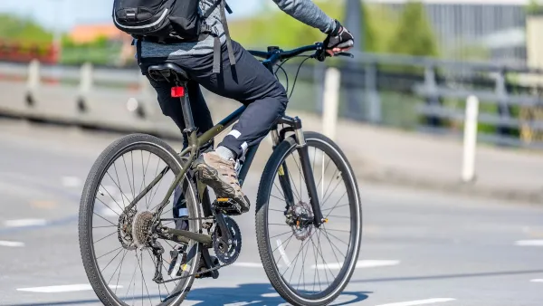
A new camera technology can detect when vehicles pass too close to people on bikes.

A handlebar-mounted camera technology developed at the University of Arizona and Arizona State University could help keep cyclists safer on the road by collecting data about close-passing drivers, reports Kea Wilson for Streetsblog USA.
The camera is paired with a sensor that detects when a vehicle passes dangerously close to a cyclist and collects information that can be used for legal evidence and, collectively, inform planners and policymakers about close-passing “hot spots” and where safe bike infrastructure is lacking.
According to Wilson, “One Australian study estimates that up to 38 percent of motor vehicle drivers who hit cyclists were either overtaking or close-passing the vulnerable road user. But similar stats are hard to come by in most U.S. jurisdictions.” Now, advocates hope that technology like CycleSafe, as the sensor is dubbed, will help change that.
Robert Heinrichs, associate professor at Arizona State's School of Computing and Augmented Intelligence, says “it's not impossible that the CycleSafe software could someday be programmed to automatically notify EMS when a serious crash is detected, potentially saving lives in hit-and-runs; it could also generate video footage for educational campaigns aimed at showing drivers just how terrifying a close pass really is for a person in the saddle.”
FULL STORY: New Camera Tech Hopes to Stop Drivers From Close-Passing Cyclists

Research Affirms Safety of ‘Idaho Stop’
Allowing cyclists to treat stop signs as yield signs does not negatively impact safety and can help people on bikes more effectively navigate roadways.

The Most Bike-Friendly States in the Nation
The League of American Bicyclists ranks states based on bike infrastructure and safety efforts.
Opinion: Sharrows Are 'Make Believe Infrastructure'
The road markings known as 'sharrows' are meant to make streets safer for cyclists, but critics argue they're nothing but a convenient compromise that favors drivers and fails to improve road safety.

National Parks Layoffs Will Cause Communities to Lose Billions
Thousands of essential park workers were laid off this week, just before the busy spring break season.

Retro-silient?: America’s First “Eco-burb,” The Woodlands Turns 50
A master-planned community north of Houston offers lessons on green infrastructure and resilient design, but falls short of its founder’s lofty affordability and walkability goals.

Delivering for America Plan Will Downgrade Mail Service in at Least 49.5 Percent of Zip Codes
Republican and Democrat lawmakers criticize the plan for its disproportionate negative impact on rural communities.

Test News Post 1
This is a summary

Test News Headline 46
Test for the image on the front page.

Balancing Bombs and Butterflies: How the National Guard Protects a Rare Species
The National Guard at Fort Indiantown Gap uses GIS technology and land management strategies to balance military training with conservation efforts, ensuring the survival of the rare eastern regal fritillary butterfly.
Urban Design for Planners 1: Software Tools
This six-course series explores essential urban design concepts using open source software and equips planners with the tools they need to participate fully in the urban design process.
Planning for Universal Design
Learn the tools for implementing Universal Design in planning regulations.
EMC Planning Group, Inc.
Planetizen
Planetizen
Mpact (formerly Rail~Volution)
Great Falls Development Authority, Inc.
HUDs Office of Policy Development and Research
NYU Wagner Graduate School of Public Service