


The Mission Rock project eliminates street parking, replacing it with public seating and landscaping.
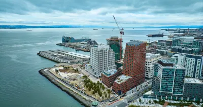
A new waterfront development in San Francisco could offer a more pedestrian-oriented model for U.S. neighborhoods, writes Nate Berg in Fast Company. “Uniquely, the neighborhood has been designed with pedestrian-first streets that do not allow on-street parking. The new street rooms are designed to give pedestrians more spaces to use along its two main corridors.”
Even in walkable San Francisco, car-free streets are rare. The 28-acre development, called Mission Rock, still offers some car access, but “The street itself at Mission Rock is revolutionary in its own regard. It was designed to be curbless, creating a completely flat 60-foot canyon between the building frontages on either side. Subtle steel grates provide drainage and a marker between the narrow car-accessible space and the rest of the public realm, and a small trapezoidal grade elevation makes a perceptible barrier for the visually impaired.”
The project includes three “street rooms” that center on public art that is designed to be sat on, climbed, or rested under. According to CMG Landscape Architecture cofounder Willett Moss, “The street rooms were developed to be places that people can hang out. They are, in this case, places where things are whimsical, and different identities and qualities and experiences can be expressed.”
FULL STORY: San Francisco’s newest neighborhood offers a glimpse of life without cars

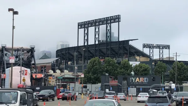
Sports-Related Development Transforming San Francisco's Waterfront South of Downtown
The Giants announced two massive development proposals in recent weeks, and the Warriors are opening a new arena to regular season games later this week.

How Well Will San Francisco’s Daylighting Program Work?
Unlike other efforts to prevent cars from parking near intersections to improve visibility and road safety, San Francisco has no plans to install physical infrastructure to keep vehicles out of danger zones.
Dallas Considers Nixing Parking Requirements
According to one local official, Dallas projects routinely build 20 to 30 percent more parking than they need, driving up the cost of housing and leading to unsustainable land use patterns.

National Parks Layoffs Will Cause Communities to Lose Billions
Thousands of essential park workers were laid off this week, just before the busy spring break season.

Retro-silient?: America’s First “Eco-burb,” The Woodlands Turns 50
A master-planned community north of Houston offers lessons on green infrastructure and resilient design, but falls short of its founder’s lofty affordability and walkability goals.

Delivering for America Plan Will Downgrade Mail Service in at Least 49.5 Percent of Zip Codes
Republican and Democrat lawmakers criticize the plan for its disproportionate negative impact on rural communities.

Test News Post 1
This is a summary

Test News Headline 46
Test for the image on the front page.

Balancing Bombs and Butterflies: How the National Guard Protects a Rare Species
The National Guard at Fort Indiantown Gap uses GIS technology and land management strategies to balance military training with conservation efforts, ensuring the survival of the rare eastern regal fritillary butterfly.
Urban Design for Planners 1: Software Tools
This six-course series explores essential urban design concepts using open source software and equips planners with the tools they need to participate fully in the urban design process.
Planning for Universal Design
Learn the tools for implementing Universal Design in planning regulations.
EMC Planning Group, Inc.
Planetizen
Planetizen
Mpact (formerly Rail~Volution)
Great Falls Development Authority, Inc.
HUDs Office of Policy Development and Research
NYU Wagner Graduate School of Public Service