


The draft plan targets improvements on 385 road segments.

The San Francisco Municipal Transportation Agency (SFMTA) board is set to review the city’s draft Biking and Rolling plan, which sets the goal of putting a “safe bike route” within a quarter mile of every resident’s home.
As Rachel Swan explains in the San Francisco Chronicle, “The current draft lists 385 routes or street segments that are targeted for upgrades, ranging from brighter striping on crosswalks, to barriers along bike lanes.” The city wants to encourage residents to use bikes for short, local trips by making neighborhood roads safer for kids and older riders, particularly near schools.
The plan calls for more interconnected bikeways, speed bumps, and other measures to improve safety and link existing bike lanes, as well as reducing conflicts between pedestrians and scooters. But it could face backlash from residents concerned about the loss of parking and driving lanes.
Swan adds, “Roads are a utility. But they also reflect a city’s values. For decades, San Franciscans have battled over how streets should function and which transportation modes should get priority. In recent years, SFMTA has reclaimed space from cars and dedicated it for bikes, scooters, or pedestrians, instituting a ‘quick-build’ process to streamline these projects.”
FULL STORY: S.F. to unveil its most ambitious bicycle plan in years, targeting hundreds of routes for upgrades

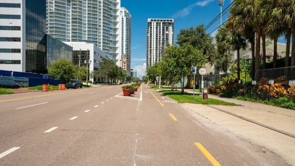
St. Petersburg’s Bike Infrastructure Efforts Pay Off
New bike infrastructure is encouraging more people to take to the streets on two wheels, but advocates say safety challenges remain.

Bike Resolutions for the New Year
A list of ways people can enhance their biking experience, appreciate the joy of cycling, and support safer bike infrastructure.

The Most Bike-Friendly States in the Nation
The League of American Bicyclists ranks states based on bike infrastructure and safety efforts.

National Parks Layoffs Will Cause Communities to Lose Billions
Thousands of essential park workers were laid off this week, just before the busy spring break season.

Retro-silient?: America’s First “Eco-burb,” The Woodlands Turns 50
A master-planned community north of Houston offers lessons on green infrastructure and resilient design, but falls short of its founder’s lofty affordability and walkability goals.

Delivering for America Plan Will Downgrade Mail Service in at Least 49.5 Percent of Zip Codes
Republican and Democrat lawmakers criticize the plan for its disproportionate negative impact on rural communities.

Test News Post 1
This is a summary

Test News Headline 46
Test for the image on the front page.

Balancing Bombs and Butterflies: How the National Guard Protects a Rare Species
The National Guard at Fort Indiantown Gap uses GIS technology and land management strategies to balance military training with conservation efforts, ensuring the survival of the rare eastern regal fritillary butterfly.
Urban Design for Planners 1: Software Tools
This six-course series explores essential urban design concepts using open source software and equips planners with the tools they need to participate fully in the urban design process.
Planning for Universal Design
Learn the tools for implementing Universal Design in planning regulations.
EMC Planning Group, Inc.
Planetizen
Planetizen
Mpact (formerly Rail~Volution)
Great Falls Development Authority, Inc.
HUDs Office of Policy Development and Research
NYU Wagner Graduate School of Public Service