


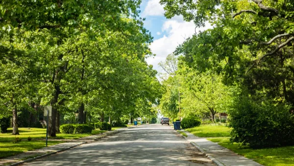
A new national tree canopy assessment tool, available at TreesAtWork.org, provides high-resolution data to help cities track tree cover changes, prioritize planting efforts, and enhance urban resilience.

A new national tree canopy assessment tool is now available, providing cities across the U.S. with high-resolution data to evaluate local and regional tree cover and track changes over time. As urban areas face increasing challenges from extreme heat, storms, and air pollution, this tool equips community leaders with essential insights to prioritize tree planting and protection efforts where they are needed most. Developed through a collaboration between the Arbor Day Foundation, PlanIT Geo, and the USDA Forest Service Urban and Community Forestry program, the tool enables users to analyze land cover statistics, urban development patterns, and tree canopy data down to the census block group level, fostering more strategic and equitable urban forestry initiatives.
Hosted at TreesAtWork.org, the platform will continue to expand with additional data and resources throughout 2025, including a National Baseline Canopy Assessment Report that will provide an in-depth analysis of urban tree canopy trends nationwide. By offering actionable intelligence on tree loss and investment impacts, the tool supports cities in making informed decisions to enhance climate resilience, improve air quality, and expand equitable green infrastructure. As Dan Lambe, CEO of the Arbor Day Foundation, emphasized, this tool represents a significant step toward shaping healthier, more sustainable communities through strategic urban forestry planning.
FULL STORY: New National Tree Canopy Assessment Tool Now Live


Growing Green: How Parks and Trees Shape Honolulu’s Future
Honolulu is expanding its urban tree canopy through community-driven park revitalization efforts, emphasizing the environmental, social, and cultural benefits of trees in creating a more resilient and equitable city.

Urban Forestry as a Pathway to Equity and Opportunity
Urban forestry job training programs are creating economic opportunities for underrepresented individuals while addressing workforce shortages and advancing tree equity in communities most impacted by environmental disparities.
How AI Is Revolutionizing Urban Forestry and Climate Resilience
Tree-D Fusion, an AI-driven tool developed by MIT and Purdue researchers, generates 3D models of urban trees to help city planners visualize future green spaces, address climate challenges, and enhance urban livability and sustainability.

National Parks Layoffs Will Cause Communities to Lose Billions
Thousands of essential park workers were laid off this week, just before the busy spring break season.

Retro-silient?: America’s First “Eco-burb,” The Woodlands Turns 50
A master-planned community north of Houston offers lessons on green infrastructure and resilient design, but falls short of its founder’s lofty affordability and walkability goals.

Delivering for America Plan Will Downgrade Mail Service in at Least 49.5 Percent of Zip Codes
Republican and Democrat lawmakers criticize the plan for its disproportionate negative impact on rural communities.

Test News Post 1
This is a summary

Test News Headline 46
Test for the image on the front page.

Balancing Bombs and Butterflies: How the National Guard Protects a Rare Species
The National Guard at Fort Indiantown Gap uses GIS technology and land management strategies to balance military training with conservation efforts, ensuring the survival of the rare eastern regal fritillary butterfly.
Urban Design for Planners 1: Software Tools
This six-course series explores essential urban design concepts using open source software and equips planners with the tools they need to participate fully in the urban design process.
Planning for Universal Design
Learn the tools for implementing Universal Design in planning regulations.
EMC Planning Group, Inc.
Planetizen
Planetizen
Mpact (formerly Rail~Volution)
Great Falls Development Authority, Inc.
HUDs Office of Policy Development and Research
NYU Wagner Graduate School of Public Service