


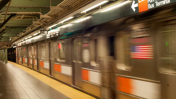
The app gives step-by-step directions and audio and visual cues accessible from anywhere for thousands of bus stops and rail stations.
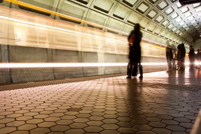
Passengers with visual impairments on the D.C.-area transit system can now use an app to navigate the network, making the Washington Metropolitan Area Transit Authority’s system one of the nation’s most accessible, according to a press release from app developer Waymap.
As Kea Wilson explains in an article in Streetsblog USA, the app relies on the phone’s motion sensors to let users navigate even underground, making it potentially “the first and only indoor mapping service that requires no external infrastructure to work.” It also provides turn-by-turn audio cues and touts “step-level accuracy.”
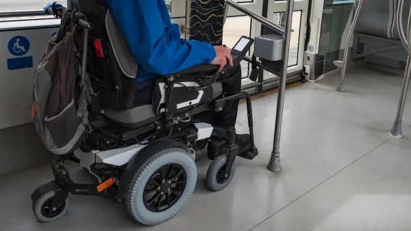
Wilson’s article points out that the app has had unexpected benefits for users beyond people with visual impairments. “Users can request routes that avoid stairs, escalators, and elevators, for instance, or ask the app to send them alerts about the exact location of wheelchair ramps before they leave the house and find themselves stranded without one. They can fine tune the speed and pitch of audio alerts to match their preferences and cognitive needs, as well as switch between four different languages.”
The company hopes the app can offer a more inclusive transit experience and plans to expand to more cities, as well as map the interior of other locations such as grocery stores and hospitals to offer a more complete end-to-end travel experience. While Washington, D.C. is the first system to be fully available on the platform, the app is also live in some locations in other cities including Los Angeles, Brisbane, Australia, and Madrid, Spain.
FULL STORY: This App Could Make D.C. One of the Most Accessible Transit Networks In the World

USDOT Issues Accessibility Guidelines for Transit Stations
A new rule aims to clarify accessibility requirements to help state and local DOTs upgrade their facilities more quickly to meet ADA standards.
Report: NYC Transit Accessibility Depends on Congestion Pricing Revenue
The ability of the MTA to complete its accessibility upgrades relies on funding from the upcoming congestion pricing program.
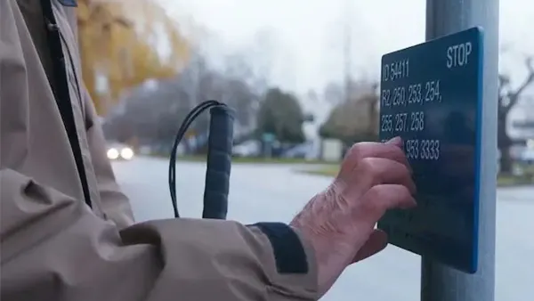
Braille Signage Now at All Vancouver Bus Stops
The city completed installation of signage for people with visual impairments at over 8,000 bus stops.

National Parks Layoffs Will Cause Communities to Lose Billions
Thousands of essential park workers were laid off this week, just before the busy spring break season.

Retro-silient?: America’s First “Eco-burb,” The Woodlands Turns 50
A master-planned community north of Houston offers lessons on green infrastructure and resilient design, but falls short of its founder’s lofty affordability and walkability goals.

Delivering for America Plan Will Downgrade Mail Service in at Least 49.5 Percent of Zip Codes
Republican and Democrat lawmakers criticize the plan for its disproportionate negative impact on rural communities.

Test News Post 1
This is a summary

Test News Headline 46
Test for the image on the front page.

Balancing Bombs and Butterflies: How the National Guard Protects a Rare Species
The National Guard at Fort Indiantown Gap uses GIS technology and land management strategies to balance military training with conservation efforts, ensuring the survival of the rare eastern regal fritillary butterfly.
Urban Design for Planners 1: Software Tools
This six-course series explores essential urban design concepts using open source software and equips planners with the tools they need to participate fully in the urban design process.
Planning for Universal Design
Learn the tools for implementing Universal Design in planning regulations.
EMC Planning Group, Inc.
Planetizen
Planetizen
Mpact (formerly Rail~Volution)
Great Falls Development Authority, Inc.
HUDs Office of Policy Development and Research
NYU Wagner Graduate School of Public Service