


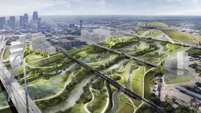
With a plan to build a Trinity Toll Road a thing of the past, there are now two plans for parks along the Trinity River. One would "rewild" the watershed.
Peter Simek provides in-depth coverage of the current state of park and open space planning along the Trinity River in Dallas.
Plans first announced in 2016 for a new park designed by acclaimed landscape architect Michael van Valkenburgh lead to the "creation of a new quasi-governmental agency—a Local Governmental Corporation—to oversee the construction of the new park," explains Simek. As reported in 2017, river boosters lead by former councilmember Angela Hunt have also hatched plans for another park.
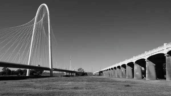
The planned Harold Simmons Park is only slated to be constructed between a 200-acre section of the floodway between the Ron Kirk Pedestrian Bridge and Interstate 30, a relatively small portion of the overall floodplain. What if there was a way to extend the restoration of the floodplain to a greater portion of the floodway?
Simek adds:
Since that time, Hunt and her collaborators have been kicking the tires and gathering supporters that include the National Audubon Society, which also helped coordinate last Saturday’s initial meeting. The group has identified a portion of the Trinity just north of the planned Simmons Park—between the Kirk Bridge and the Sylvan Avenue overpass (but excluding the existing Trammel Crow Park in the floodway). They believe this area can be restored into the kind of river-driven landscape that once characterized the Trinity floodplain before humans settled it.
Simek examines the politics of planning along the Trinity River, while also describing the planning and visioning exercises of the multiple groups working to implement a new vision for the Trinity River.
FULL STORY: Dallas May Now Get Two New Trinity River Parks

A Closer Look at the Big Park Plans Along Dallas' Trinity River
The Trinity River Project is coming into focus, after years of planning and decades of discussion. A $50 million donation in 2016 provided a big boost for Dallas' ambitious plans.
Is This the Trinity Park Plan of Dallas' Dreams?
Architecture critic Mark Lamster finally sees a proposal worth cheering for in Dallas' plans for a new park along the Trinity River.
Critic Sees 'Dallas Logic' in Latest Trinity River Plans
Mark Lamster has eviscerated the city of Dallas for its plans to build the Trinity Toll Road before—and he'll probably do it again.

National Parks Layoffs Will Cause Communities to Lose Billions
Thousands of essential park workers were laid off this week, just before the busy spring break season.

Retro-silient?: America’s First “Eco-burb,” The Woodlands Turns 50
A master-planned community north of Houston offers lessons on green infrastructure and resilient design, but falls short of its founder’s lofty affordability and walkability goals.

Delivering for America Plan Will Downgrade Mail Service in at Least 49.5 Percent of Zip Codes
Republican and Democrat lawmakers criticize the plan for its disproportionate negative impact on rural communities.

Test News Post 1
This is a summary

Test News Headline 46
Test for the image on the front page.

Balancing Bombs and Butterflies: How the National Guard Protects a Rare Species
The National Guard at Fort Indiantown Gap uses GIS technology and land management strategies to balance military training with conservation efforts, ensuring the survival of the rare eastern regal fritillary butterfly.
Urban Design for Planners 1: Software Tools
This six-course series explores essential urban design concepts using open source software and equips planners with the tools they need to participate fully in the urban design process.
Planning for Universal Design
Learn the tools for implementing Universal Design in planning regulations.
EMC Planning Group, Inc.
Planetizen
Planetizen
Mpact (formerly Rail~Volution)
Great Falls Development Authority, Inc.
HUDs Office of Policy Development and Research
NYU Wagner Graduate School of Public Service