


Integrating autonomous vehicles into cities will require effectively managing city streets and suburban sprawl.
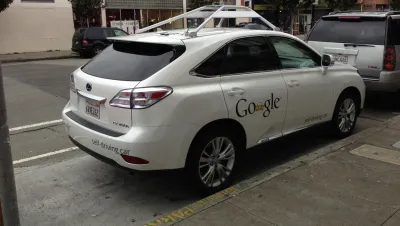
In an excerpt from his new book Walkable City Rules: 101 Steps to Making Better Places, Jeff Speck considers the future of autonomous vehicles and their place in the urban landscape.
Speck argues that while advocates of AVs outline a multitude of potential benefits, an alternative take is less positive:
History would suggest that the widely held vision of swarming public fleets, uninterrupted by private and non-autonomous cars, is unlikely to happen in the United States, where no city has ever shown the willingness to limit private car use in any meaningful way, despite crippling traffic.
Speck says AVs on American roads will result in more car travel, not less. As a result, the focus for cities should be on regulating roadways. “In an AV future, each city street would ideally be allocated a limited number of driving lanes, no more than currently present. Only in this way will our downtowns remain welcoming to more than just cars,” says Speck.
In addition, AVs will encourage travel over longer distances and so cities must work to contain the suburban sprawl that this travel will encourage. Cities also need to strategically manage the relationship between AVs and transit, says Speck. The significantly higher capacity of transit vehicles means that urban mobility in cities grappling with congestion would be hampered if transit is swapped out for low-capacity AVs.
FULL STORY: Walkable City Rules: Don’t Expand City Streets for Self-Driving Cars

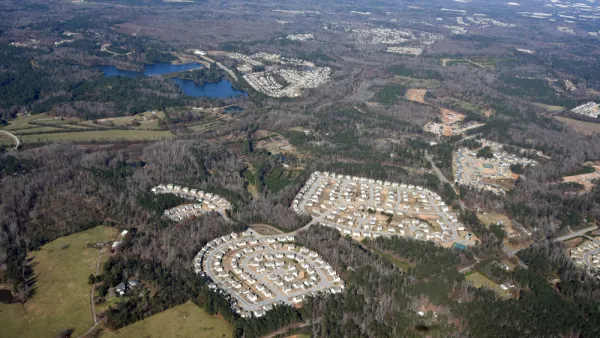
CNU Report Outlines Incremental Steps for More Walkable Suburbs
Transforming suburban sprawl is a massive undertaking, but these small steps can help communities understand their needs and assets and develop clear, actionable goals for the future.
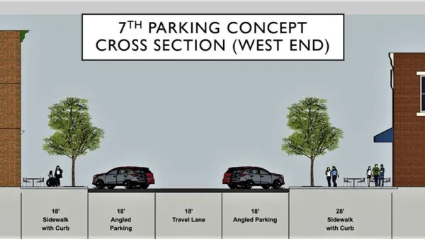
Street Redesign as an Economic Development Tool
The city of Covington in Kentucky is working on street improvements on key downtown streets in the hopes of attracting new business to the area.

U.S. Lagging in Making Streets Safer for Pedestrians
Pedestrian deaths are on the rise in the United States, but cities have been slow to implement effective policies and road design measures to change the trend.

National Parks Layoffs Will Cause Communities to Lose Billions
Thousands of essential park workers were laid off this week, just before the busy spring break season.

Retro-silient?: America’s First “Eco-burb,” The Woodlands Turns 50
A master-planned community north of Houston offers lessons on green infrastructure and resilient design, but falls short of its founder’s lofty affordability and walkability goals.

Delivering for America Plan Will Downgrade Mail Service in at Least 49.5 Percent of Zip Codes
Republican and Democrat lawmakers criticize the plan for its disproportionate negative impact on rural communities.

Test News Post 1
This is a summary

Test News Headline 46
Test for the image on the front page.

Balancing Bombs and Butterflies: How the National Guard Protects a Rare Species
The National Guard at Fort Indiantown Gap uses GIS technology and land management strategies to balance military training with conservation efforts, ensuring the survival of the rare eastern regal fritillary butterfly.
Urban Design for Planners 1: Software Tools
This six-course series explores essential urban design concepts using open source software and equips planners with the tools they need to participate fully in the urban design process.
Planning for Universal Design
Learn the tools for implementing Universal Design in planning regulations.
EMC Planning Group, Inc.
Planetizen
Planetizen
Mpact (formerly Rail~Volution)
Great Falls Development Authority, Inc.
HUDs Office of Policy Development and Research
NYU Wagner Graduate School of Public Service