


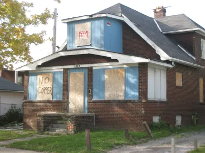
Cleveland neighborhoods were coded to help real estate investors, but the result is a map that harks back to old discriminatory housing practices, say critics.
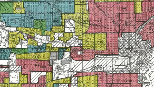
Brentin Mock reports on recent controversy over a 2015 blog post about a map of Cleveland that looks much like redlining maps from the last century. The map, produced by a local real estate developer, graded the city’s neighborhoods, ostensibly to provide investors with a guide to where they might get the best return on investments.
But, says Mock, the grades highlight race and class segregation throughout the city:
The red “F” category is called the “Warzone” in [James] Wise’s blog, and consists of the African-American East Cleveland neighborhood and several zip codes that have majority black populations, and most of which have incomes below $22,000. The D category, also red, consists of just three neighborhoods, each of which have sizable black and Latino populations, all located in the city and with majority renter populations.
The Home Owners Loan Corporation redlining maps of the 1930s divided the city based on similar metrics, and designations of “neighborhood desirability” drove investment and home loan decisions. “Desirability was defined by the neighborhood’s household incomes, the percentage of homeowners, and by 'homogeneity'—whether white people made up the majority of the neighborhood,” reports Mock.
Some housing advocates wonder if the more recent map could actually help residents in lower-income neighborhoods over the long run. Investors looking to flip properties and make a quick buck might be motivated to steer clear of Cleveland’s most vulnerable neighborhoods, says Mock.
FULL STORY: The Brazen Redlining Happening in Cleveland

Putting the Myth of the Redlining Maps to Rest
Home Owners’ Loan Corporation (HOLC) maps have long been blamed for racial inequities in today’s Black neighborhoods, but recent research shows that’s misleading.
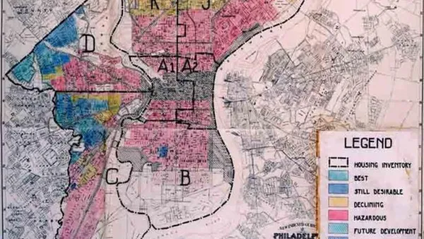
New Research Reexamines HOLC's Role in Redlining
New Deal agencies did engage in discriminatory lending practices–but not quite in the way we think.
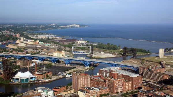
Cleveland Has Yet to Recover From the Last Recession
Decades of racist policy and a lack of critical resources have left Cleveland in a perpetual state of economic fragility. The city can't afford another recession.

Analysis: Cybertruck Fatality Rate Far Exceeds That of Ford Pinto
The Tesla Cybertruck was recalled seven times last year.

National Parks Layoffs Will Cause Communities to Lose Billions
Thousands of essential park workers were laid off this week, just before the busy spring break season.

Retro-silient?: America’s First “Eco-burb,” The Woodlands Turns 50
A master-planned community north of Houston offers lessons on green infrastructure and resilient design, but falls short of its founder’s lofty affordability and walkability goals.

Test News Post 1
This is a summary

Analysis: Cybertruck Fatality Rate Far Exceeds That of Ford Pinto
The Tesla Cybertruck was recalled seven times last year.

Test News Headline 46
Test for the image on the front page.
Urban Design for Planners 1: Software Tools
This six-course series explores essential urban design concepts using open source software and equips planners with the tools they need to participate fully in the urban design process.
Planning for Universal Design
Learn the tools for implementing Universal Design in planning regulations.
EMC Planning Group, Inc.
Planetizen
Planetizen
Mpact (formerly Rail~Volution)
Great Falls Development Authority, Inc.
HUDs Office of Policy Development and Research
NYU Wagner Graduate School of Public Service