


University of California, Berkeley researchers have mapped the impact of SB 50, a bill that would allow new density around train stations and bus stops in cities all over the state of California.
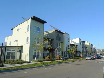
A new interactive mapping tool from the urban Displacement Project and the Terner Center for Housing Innovation at the University of California, Berkeley illustrates the potential impact of SB 50, the statewide transit oriented upzoning bill authored by State Senator Scott Weiner as a follow up to last year's SB 827.
Jenna Chandler reports on the new mapping tool, explaining how to use the map to visualize the changes the bill could clear the way for in the name of creating more housing supply and lowering housing costs around the state.
"The analysis and map look at neighborhoods surrounding 'high-quality' transit stops and categorize them into five neighborhood types based on existing density and income: high density and high income (blue); high density and low income (green); low density and high income (red); low density and low income (yellow); and low density and diverse (purple)," explains Chandler.
"They study takes into consideration how much land is zoned for residential uses, how much is vacant and 'underutilized,' and how many existing buildings are renter-occupied. To help prevent displacement, SB 50 has a provision that exempts buildings that have been occupied by tenants within the past seven years."
Carolina Reid, faculty research advisor for the Terner Center for Housing Innovation, is also quoted in the article providing more insight into the message the team hoped to impart in creating the mapping tool.
FULL STORY: Map shows which LA neighborhoods might be impacted by California transit density bill


SB 827: Part 2
California State Senator Scott Wiener has released the highly anticipated follow up to last year's failed bombshell of a housing bill, SB 827.
Amendments Proposed for California's Landmark Pro-Housing Development Legislation
Amendments are circulating for one of the most-closely watched, and passionately debated, pieces of housing legislation in the country.

Updated: Statewide Upzoning Falls Short Again in California
For the third year in a row, an effort to increase density near transit in statewide in California has stalled in the legislature.

Analysis: Cybertruck Fatality Rate Far Exceeds That of Ford Pinto
The Tesla Cybertruck was recalled seven times last year.

National Parks Layoffs Will Cause Communities to Lose Billions
Thousands of essential park workers were laid off this week, just before the busy spring break season.

Retro-silient?: America’s First “Eco-burb,” The Woodlands Turns 50
A master-planned community north of Houston offers lessons on green infrastructure and resilient design, but falls short of its founder’s lofty affordability and walkability goals.

Test News Post 1
This is a summary

Analysis: Cybertruck Fatality Rate Far Exceeds That of Ford Pinto
The Tesla Cybertruck was recalled seven times last year.

Test News Headline 46
Test for the image on the front page.
Urban Design for Planners 1: Software Tools
This six-course series explores essential urban design concepts using open source software and equips planners with the tools they need to participate fully in the urban design process.
Planning for Universal Design
Learn the tools for implementing Universal Design in planning regulations.
EMC Planning Group, Inc.
Planetizen
Planetizen
Mpact (formerly Rail~Volution)
Great Falls Development Authority, Inc.
HUDs Office of Policy Development and Research
NYU Wagner Graduate School of Public Service