


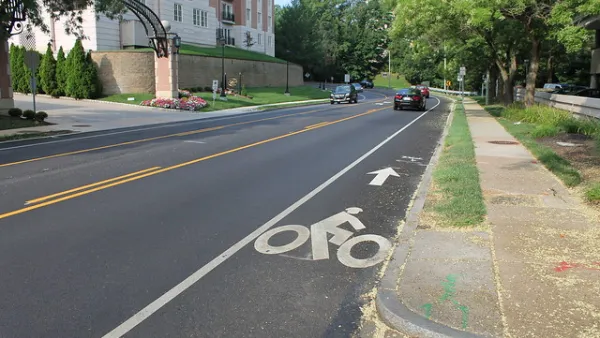
Faced with rapidly deteriorating pedestrian safety statistics, Montgomery County in Maryland is getting to work on a new Pedestrian Plan, following closely on the heels of work completed for the county's Bicycle Master Plan.

The Montgomery County Planning Department is launching a multi-year pedestrian planning effort, according to an article by Caitlyn Peetz.
The Pedestrian Master Plan that will result will complement the Bicycle Master Plan approved by the county last year, according to Peetz.
Similar to the process used to generate the Bicycle Master Plan, planners will perform a "comfort analysis" of the county's pedestrian infrastructure, assessing "each street’s pedestrian experience including factors like the street’s speed limit and sidewalk width," according to Peetz. "Then, planners will develop what is expected to be a lengthy list of recommendations to improve roads, from adding crosswalks to installing more lights at intersections."
The plan can come soon enough, according to Peetz, as vehicle collisions involving pedestrians increased by 14 percent so far this as compared to the same time period last year.
FULL STORY: County Analyzing Streets for ‘Pedestrian Comfort’ and Safety


Resources for Safe, Convenient Pedestrian and Bike Infrastructure
Despite the stated goals of state and federal agencies to encourage active modes of transportation, there's still a long way to go to make sure that all cities and communities have safe, convenient sidewalks and bike lanes.
On Foot: Planners Complete Street Safety Inventory One Step at a Time
Before drafting a new Pedestrian Master Plan for Montgomery County, planners are creating a detailed inventory of street conditions by walking every single one fo the county's roads and streets.

Has Progress on Travel Safety Run Off the Road?
Changing technology and rebuilding infrastructure to improve road safety are long-term strategies. How can enforcement and interventions that influence driver behavior make a difference in reducing traffic deaths sooner?

National Parks Layoffs Will Cause Communities to Lose Billions
Thousands of essential park workers were laid off this week, just before the busy spring break season.

Retro-silient?: America’s First “Eco-burb,” The Woodlands Turns 50
A master-planned community north of Houston offers lessons on green infrastructure and resilient design, but falls short of its founder’s lofty affordability and walkability goals.

Delivering for America Plan Will Downgrade Mail Service in at Least 49.5 Percent of Zip Codes
Republican and Democrat lawmakers criticize the plan for its disproportionate negative impact on rural communities.

Test News Post 1
This is a summary

Test News Headline 46
Test for the image on the front page.

Balancing Bombs and Butterflies: How the National Guard Protects a Rare Species
The National Guard at Fort Indiantown Gap uses GIS technology and land management strategies to balance military training with conservation efforts, ensuring the survival of the rare eastern regal fritillary butterfly.
Urban Design for Planners 1: Software Tools
This six-course series explores essential urban design concepts using open source software and equips planners with the tools they need to participate fully in the urban design process.
Planning for Universal Design
Learn the tools for implementing Universal Design in planning regulations.
EMC Planning Group, Inc.
Planetizen
Planetizen
Mpact (formerly Rail~Volution)
Great Falls Development Authority, Inc.
HUDs Office of Policy Development and Research
NYU Wagner Graduate School of Public Service