


In Houston, 60 percent of serious automobile crashes occur on 6 percent of the city's streets. A New Vision Zero Action Plan will focus safety improvements on those streets with a high density of traffic deaths and serious injuries.
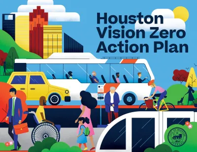
The city of Houston this week launched a new Vision Zero Action Plan (VZAP) "to end traffic deaths and serious injuries by 2030 and improve street safety and equity for road users of all ages, abilities and modes of transportation," according to a press release from the office of Mayor Sylvester Turner.
"More than 200 people die and nearly 1,000 people are seriously injured in crashes on Houston roadways every year," according to the press release.
The launch of the VZAP comes over a year after the city committed to Vision Zero. "After extensive data analysis, community engagement and multiagency collaboration, the City of Houston created the Vision Zero Action Plan."
According to the press release, that analysis included mapping out rates of fatalities and serious injuries in traffic collisions.
The city's Planning and Development Department will spearhead the coalition of city and regional agencies tasked with four key goals to achieve Vision Zero: 1) create a safe, equitable, and accessible network of streets, 2) make walking, rolling, and biking safe, 3) make connecting to transit safe, and 4) make driving safe.
FULL STORY: Mayor Turner launches Vision Zero Action Plan to eliminate traffic deaths in Houston by 2030

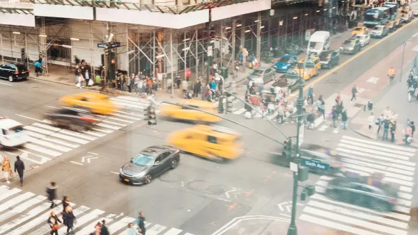
NYC Pedestrian Deaths Rose in 2024
The city’s Vision Zero efforts seem to have stalled.
Portland Traffic Deaths Surpass 2022 Number
This year, 69 people have died in traffic crashes in Portland, Oregon, nearly twice as many as in 2018, when the city began its Vision Zero program.

Audit: Portland’s Vision Zero Needs More Data, Funding
A city audit found that the program has failed to reduce traffic deaths and could benefit from a more systematic approach. Meanwhile, PBOT says it needs more state funding to support road safety projects.

National Parks Layoffs Will Cause Communities to Lose Billions
Thousands of essential park workers were laid off this week, just before the busy spring break season.

Retro-silient?: America’s First “Eco-burb,” The Woodlands Turns 50
A master-planned community north of Houston offers lessons on green infrastructure and resilient design, but falls short of its founder’s lofty affordability and walkability goals.

Delivering for America Plan Will Downgrade Mail Service in at Least 49.5 Percent of Zip Codes
Republican and Democrat lawmakers criticize the plan for its disproportionate negative impact on rural communities.

Test News Post 1
This is a summary

Test News Headline 46
Test for the image on the front page.

Balancing Bombs and Butterflies: How the National Guard Protects a Rare Species
The National Guard at Fort Indiantown Gap uses GIS technology and land management strategies to balance military training with conservation efforts, ensuring the survival of the rare eastern regal fritillary butterfly.
Urban Design for Planners 1: Software Tools
This six-course series explores essential urban design concepts using open source software and equips planners with the tools they need to participate fully in the urban design process.
Planning for Universal Design
Learn the tools for implementing Universal Design in planning regulations.
EMC Planning Group, Inc.
Planetizen
Planetizen
Mpact (formerly Rail~Volution)
Great Falls Development Authority, Inc.
HUDs Office of Policy Development and Research
NYU Wagner Graduate School of Public Service