


University of Hawaii graduate students explored the potential for improvements to the Ala Wai Small Boat Harbor, an important coastal public space in Honolulu.
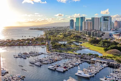
Coastal planning is complicated and challenging even for seasoned planners due in part to the variety of issues and stakeholders involved. But that has not discouraged planning and landscape architecture students from the University of Hawaii at Manoa from studying Ala Wai Small Boat Harbor and offering recommendations for its improvement. Specifically, students in two graduate classes recently explored the potential for short- and long-term improvements to the harbor which is an important coastal public space that serves as a link between Ala Moana and Waikīkī.
The students in a planning practicum and a landscape architecture studio also examined how projected sea-level rise would impact the harbor. They conducted research, gathered input from stakeholders, studied precedents, and explored design strategies to tackle the issue. The findings informed their conceptual plan and recommendations for climate risk adaptation as well as for site improvements to enhance this public amenity. The students appreciated the opportunity to work on a real-world assignment to assist the state’s Division of Boating and Ocean Recreation and gain valuable experience and skills to prepare them for the transition to becoming professionals.
Ala Wai Harbor is the largest small boat and yacht harbor in Hawaii. The harbor is situated in Honolulu at the mouth of the Ala Wai Canal, between Waikiki and downtown Honolulu. To the east are Waikiki and Diamond Head; to the west are Magic Island and the Honolulu waterfront. Ala Wai Harbor has a rich cultural history and land uses that support recreational activities. Research shows that the harbor will be impacted by sea-level rise in the coming years. Thus, it is critical for any future plans to address this issue while taking into consideration the public’s vision for the harbor.
FULL STORY: Ala Wai Harbor gets planning help from UH students

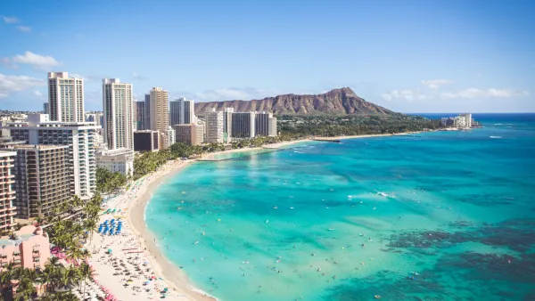
Study: Oahu Could Lose 40 Percent of its Beaches by 2050
A new study calls for changes to coastal management policies to better protect sandy shorelines retreating under the pressure of rising sea levels.
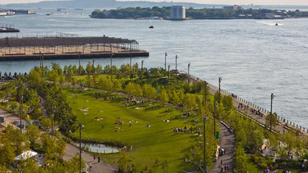
New York Updating its Comprehensive Waterfront Plan
Vision 2030 will update the award winning Vision 2020 New York City Comprehensive Waterfront Plan.
Coronavirus Success: The Unusual Story Behind the State with the Lowest Infection Rate
Like New Zealand, another island has achieved success in reducing viral spread. The ability to quarantine travelers to Hawaii was crucial, but the virus had already arrived. Health professionals played key roles which, at times, led to conflict.

National Parks Layoffs Will Cause Communities to Lose Billions
Thousands of essential park workers were laid off this week, just before the busy spring break season.

Retro-silient?: America’s First “Eco-burb,” The Woodlands Turns 50
A master-planned community north of Houston offers lessons on green infrastructure and resilient design, but falls short of its founder’s lofty affordability and walkability goals.

Delivering for America Plan Will Downgrade Mail Service in at Least 49.5 Percent of Zip Codes
Republican and Democrat lawmakers criticize the plan for its disproportionate negative impact on rural communities.

Test News Post 1
This is a summary

Test News Headline 46
Test for the image on the front page.

Balancing Bombs and Butterflies: How the National Guard Protects a Rare Species
The National Guard at Fort Indiantown Gap uses GIS technology and land management strategies to balance military training with conservation efforts, ensuring the survival of the rare eastern regal fritillary butterfly.
Urban Design for Planners 1: Software Tools
This six-course series explores essential urban design concepts using open source software and equips planners with the tools they need to participate fully in the urban design process.
Planning for Universal Design
Learn the tools for implementing Universal Design in planning regulations.
EMC Planning Group, Inc.
Planetizen
Planetizen
Mpact (formerly Rail~Volution)
Great Falls Development Authority, Inc.
HUDs Office of Policy Development and Research
NYU Wagner Graduate School of Public Service