


A new report concludes that common ‘walkability’ measures don’t account for many barriers faced by pedestrians, such as environmental factors and policing.
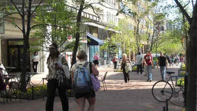
According to Kea Wilson, “if cities truly want to be pedestrian-friendly, they need to think beyond the sidewalk, particularly in neighborhoods of color that face the steepest barriers.” However, while walkability scoring tools attempt to quantify the accessibility of neighborhoods for pedestrians, they leave out important factors. “That’s mostly because walkability algorithms tend to grade neighborhoods highly when they offer a lot of destinations within ‘walking distance,‘ but don’t closely scrutinize things like pedestrian crash rates, how long it takes to cross the road, the presence or absence of sidewalks, or even whether or not people you know, actually walk in a given neighborhood right now.”
A new analysis from the Urban Institute used five criteria to get a more accurate picture of actual walkability in Washington, D.C.: access to “essential destinations,” environmental quality factors such as air pollution and shade, infrastructure, policing, and road safety. “The study focused on data that could be sourced from public sources in hopes that other cities could easily replicate their work, but the researchers were forced to leave out certain critical and under-studied walking barriers, like rates of gender-based street harassment, accessibility for people with disabilities, and flood patterns in communities with poor drainage.”
“Still, the researchers say that’s all the more reason for city leaders to expand the kinds of data they collect on mobility barriers among various groups — and to think just as broadly about how improving one metric, like the prevalence of ‘self-enforcing’ street designs, could possibly improve other metrics, like decreasing the number of police stops.”
FULL STORY: Why ‘Walkability’ Scores Don’t Tell Us How Pedestrian-Friendly a City Is For Everyone

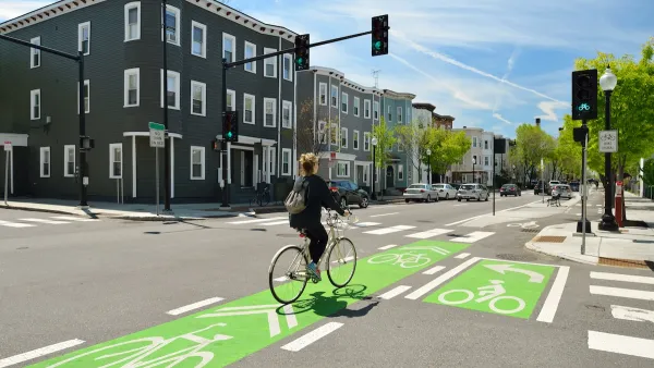
NACTO Releases Updated Urban Bikeway Guide
The third edition of the nationally recognized road design guide includes detailed design advice for roads that prioritize safety and accessibility for all users.

US Street Design Manual Inches Toward Safer Roads
The guiding document for U.S. road design is starting to recognize the needs of people walking and biking, but safe streets advocates say more significant changes are needed to reduce the high number of pedestrian deaths and improve connectivity for all road users.
Houston Developers Question Mayor’s Stance on Pedestrian Projects
The new mayor’s reversal of road safety projects, some already underway or completed, is raising eyebrows among developers who say residents want walkable, mixed-use streets.

National Parks Layoffs Will Cause Communities to Lose Billions
Thousands of essential park workers were laid off this week, just before the busy spring break season.

Retro-silient?: America’s First “Eco-burb,” The Woodlands Turns 50
A master-planned community north of Houston offers lessons on green infrastructure and resilient design, but falls short of its founder’s lofty affordability and walkability goals.

Delivering for America Plan Will Downgrade Mail Service in at Least 49.5 Percent of Zip Codes
Republican and Democrat lawmakers criticize the plan for its disproportionate negative impact on rural communities.

Test News Post 1
This is a summary

Test News Headline 46
Test for the image on the front page.

Balancing Bombs and Butterflies: How the National Guard Protects a Rare Species
The National Guard at Fort Indiantown Gap uses GIS technology and land management strategies to balance military training with conservation efforts, ensuring the survival of the rare eastern regal fritillary butterfly.
Urban Design for Planners 1: Software Tools
This six-course series explores essential urban design concepts using open source software and equips planners with the tools they need to participate fully in the urban design process.
Planning for Universal Design
Learn the tools for implementing Universal Design in planning regulations.
EMC Planning Group, Inc.
Planetizen
Planetizen
Mpact (formerly Rail~Volution)
Great Falls Development Authority, Inc.
HUDs Office of Policy Development and Research
NYU Wagner Graduate School of Public Service