


A new analysis of U.S. and Mexico groundwater supplies reveals 72 aquifers shared between the two countries.
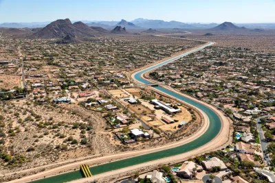
A new map of groundwater supplies could change the shape of water management and conservation policy in the U.S. Southwest and Mexico, reports Caroline Tracey in High Country News. “On Dec. 28, researchers released the first complete map of the groundwater basins that span the U.S.-Mexico boundary. It demarcates 72 shared aquifers — a striking contrast to the countries’ official count of 11.”
The map comes from research by Rosario Sánchez and Laura Rodríguez published in Transboundary Aquifers: Challenges and the Way Forward. “It shows five shared aquifers between Baja California and California, 26 between Sonora and Arizona, and 33 between Texas and the Mexican states of Chihuahua, Coahuila, Nuevo León, and Tamaulipas. Of these, 45% are considered to be in ‘good to moderate’ condition.”
The two countries have not previously collaborated on water regulation efforts, leading to incongruous uses and unsustainable exploitation of water resources, Tracey explains. The research standardizes the definition of an aquifer, which the authors hope will contribute to a better shared understanding of the intertwined water resources in the two countries. “Felicia Marcus of the Water Policy Group added that maps like the one Sánchez and Rodríguez produced ‘are helpful for transparency and allow for more engagement of the affected communities,’ particularly in resolution of disputes.”
More on the Southwest's water crisis:
FULL STORY: Researchers solve one of the Borderlands’ biggest water puzzles

Arizona Governor Takes Steps to Modernize Water Policy
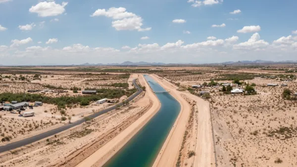
A newly released report warns of rapidly dwindling groundwater resources as developers plan to build hundreds of thousands of new homes.
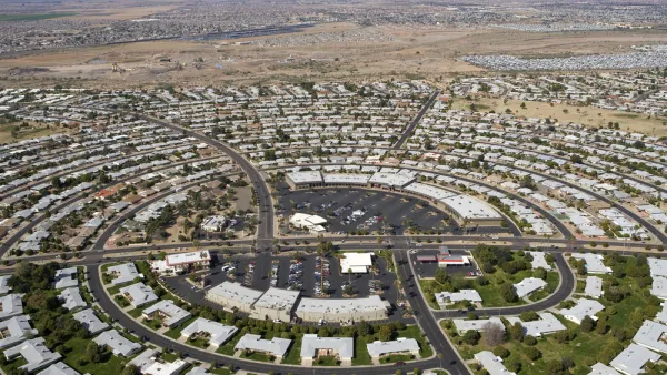
Arizona’s Growth Threatens Water Supplies
New communities are popping up across Arizona’s desert, evading water consumption restrictions and straining the state’s groundwater supplies.

Utah Debates Solutions to Water Shortage
With a rapidly growing population and strained water supplies, Utah lawmakers and conservation groups debate how to best replenish the state's water sources.

Analysis: Cybertruck Fatality Rate Far Exceeds That of Ford Pinto
The Tesla Cybertruck was recalled seven times last year.

National Parks Layoffs Will Cause Communities to Lose Billions
Thousands of essential park workers were laid off this week, just before the busy spring break season.

Retro-silient?: America’s First “Eco-burb,” The Woodlands Turns 50
A master-planned community north of Houston offers lessons on green infrastructure and resilient design, but falls short of its founder’s lofty affordability and walkability goals.

Test News Post 1
This is a summary

Analysis: Cybertruck Fatality Rate Far Exceeds That of Ford Pinto
The Tesla Cybertruck was recalled seven times last year.

Test News Headline 46
Test for the image on the front page.
Urban Design for Planners 1: Software Tools
This six-course series explores essential urban design concepts using open source software and equips planners with the tools they need to participate fully in the urban design process.
Planning for Universal Design
Learn the tools for implementing Universal Design in planning regulations.
EMC Planning Group, Inc.
Planetizen
Planetizen
Mpact (formerly Rail~Volution)
Great Falls Development Authority, Inc.
HUDs Office of Policy Development and Research
NYU Wagner Graduate School of Public Service