


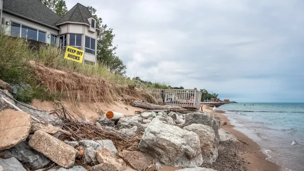
Cities and counties at risk of flooding and erosion from sea level rise can access state funding to implement coastal resiliency plans.

Northern California’s Marin County is developing a plan to address sea level rise threatening the coastal region, according to a report from Bay City News, in compliance with a new state law that “requires coastal governments to create a sea rise or shoreline resiliency plan in order to receive funding from the state to implement the plan.”
“As part of a state-mandated effort to create a shoreline resiliency plan, the county Board of Supervisors got a glimpse Tuesday of what the consequences of inaction could be if efforts are not made to protect the shoreline from rising sea levels,” the article explains. “Flooding in Marin County could impact 28,000 residents, 104,000 existing jobs, and 85,000 planned jobs, according to projections from the commission.”
Flooding could also impact rail and highway transportation networks and could affect mobility around the state, while water levels could surge by as much as 96 inches by the year 2100 without mitigation measures. Local officials are working to coordinate efforts among city and county governments in the region. “The projections are fueling a proposal to invest about $110 billion in shoreline resiliency around the Bay Area.”
FULL STORY: Marin County working to create shoreline resiliency plan to protect from sea level rise


Connecticut Shoreline Rail Vulnerable to Floods
Long stretches of Connecticut's "lifeblood" shoreline rail line lie in the path of rising seas and future floods. While moving the tracks further inland is prohibitively expensive, a resilience plan is still needed.

Rising Above: Innovative Solutions for Waikīkī’s Sea-Level Challenges
The University of Hawaiʻi at Mānoa’s award-winning Waikīkī sea-level rise adaptation project combines science, architecture, and community input to create scalable solutions for climate resilience and coastal flood mitigation.
How US Cities Can Prepare for Climate Disasters
Resilience, encompassing infrastructure, governance, economic strength, and social cohesion, is critical for cities to mitigate rising climate risks like flooding, wildfires, and heat, ensuring long-term recovery and adaptability.

National Parks Layoffs Will Cause Communities to Lose Billions
Thousands of essential park workers were laid off this week, just before the busy spring break season.

Retro-silient?: America’s First “Eco-burb,” The Woodlands Turns 50
A master-planned community north of Houston offers lessons on green infrastructure and resilient design, but falls short of its founder’s lofty affordability and walkability goals.

Delivering for America Plan Will Downgrade Mail Service in at Least 49.5 Percent of Zip Codes
Republican and Democrat lawmakers criticize the plan for its disproportionate negative impact on rural communities.

Test News Post 1
This is a summary

Test News Headline 46
Test for the image on the front page.

Balancing Bombs and Butterflies: How the National Guard Protects a Rare Species
The National Guard at Fort Indiantown Gap uses GIS technology and land management strategies to balance military training with conservation efforts, ensuring the survival of the rare eastern regal fritillary butterfly.
Urban Design for Planners 1: Software Tools
This six-course series explores essential urban design concepts using open source software and equips planners with the tools they need to participate fully in the urban design process.
Planning for Universal Design
Learn the tools for implementing Universal Design in planning regulations.
EMC Planning Group, Inc.
Planetizen
Planetizen
Mpact (formerly Rail~Volution)
Great Falls Development Authority, Inc.
HUDs Office of Policy Development and Research
NYU Wagner Graduate School of Public Service