


New York’s Department of Transportation plans to double the width of a Staten Island street to accommodate more vehicular traffic.

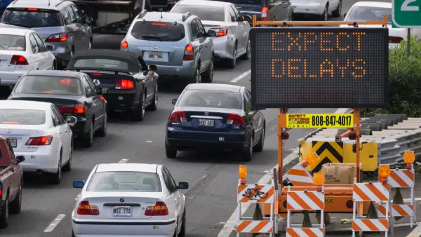
New York City officials plan to double the width of a street in Staten Island in a bid to reduce congestion, but mobility advocates say the plan will take away pedestrian space, make the street more dangerous for people with disabilities, and induce more traffic.
As Kevin Duggan explains in Streetsblog NYC, “The $24-million reconstruction of Amboy Road, covering less than a half-mile between Richmond and Armstrong avenues in Eltingville, will double the street's width from 40 feet to 80 feet to expand it from one lane each way to two, according to Department of Transportation plans dating back a decade.”
According to NYCDOT, “The plans would not only widen Amboy Road, but also also install a raised median and enhanced pedestrian crossings at intersections, which officials say would create a ‘Town Center’ environment.”
The project plan does not specify any improvements to transit along the corridor. “The project is being undertaken by DOT and the Department of Design and Construction, and it is set to start construction next spring. The DOT declined to respond to repeated questions about this project, but DDC spokesperson Ian Michaels said the project is still undergoing a final design.”
FULL STORY: Vision? Zero! City Will Widen Staten Island Roadway to Appease Drivers


Planning for Congestion Relief
The third and final installment of Planetizen's examination of the role of the planning profession in both perpetuating and solving traffic congestion.

How Planning Fails to Solve Congestion
Solutions for congestion are never as simple and easy as armchair planners and engineers would like you to believe—especially those who suggest that congestion can be solved by forever building more roadway capacity.
Planning and the Complicated Causes and Effects of Congestion
What do planners know about congestion, and what can they do about it? Explanations and solutions are less obvious than they seem (part one of a three-part series).

National Parks Layoffs Will Cause Communities to Lose Billions
Thousands of essential park workers were laid off this week, just before the busy spring break season.

Retro-silient?: America’s First “Eco-burb,” The Woodlands Turns 50
A master-planned community north of Houston offers lessons on green infrastructure and resilient design, but falls short of its founder’s lofty affordability and walkability goals.

Delivering for America Plan Will Downgrade Mail Service in at Least 49.5 Percent of Zip Codes
Republican and Democrat lawmakers criticize the plan for its disproportionate negative impact on rural communities.

Test News Post 1
This is a summary

Test News Headline 46
Test for the image on the front page.

Balancing Bombs and Butterflies: How the National Guard Protects a Rare Species
The National Guard at Fort Indiantown Gap uses GIS technology and land management strategies to balance military training with conservation efforts, ensuring the survival of the rare eastern regal fritillary butterfly.
Urban Design for Planners 1: Software Tools
This six-course series explores essential urban design concepts using open source software and equips planners with the tools they need to participate fully in the urban design process.
Planning for Universal Design
Learn the tools for implementing Universal Design in planning regulations.
EMC Planning Group, Inc.
Planetizen
Planetizen
Mpact (formerly Rail~Volution)
Great Falls Development Authority, Inc.
HUDs Office of Policy Development and Research
NYU Wagner Graduate School of Public Service