


Discover how the Sustainable Urban Design Framework helps planners create livable, sustainable communities. Nico Larco from the University of Oregon explores a new tool and book in the latest “Talking Headways” podcast.

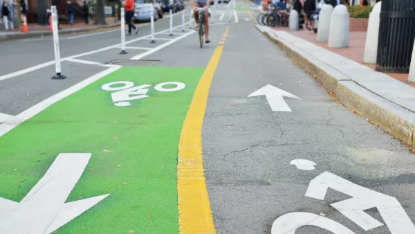
Urban planners are increasingly grappling with the difficult task of how to create more sustainable and livable communities. This has been challenging as sustainability in urban design is a complicated topic that includes a wide range of scales, disciplines, and areas of expertise. In the latest episode of the “Talking Headways” podcast, Nico Larco from the University of Oregon discusses a new, comprehensive approach based on the Sustainable Urban Design Framework and how it can be used by planners, designers, elected officials, and community stakeholders. The framework organizes a new book by Larco and Kaarin Knudson titled the Sustainable Urban Design Handbook (excerpts here).
The podcast gives an overview on the framework and describes its five sustainability-focused outcome areas (Energy Use and GHG based on Transportation and Land Use, Water, Ecology and Habitat, Energy Use and GHG Production (Non-Transportation), and Equity and Health) and four scales of intervention (Region/City, District/Neighborhood, Block/Street, Project/Parcel).
The podcast also dives deep on a few topics such as the critical role density plays in many aspects of sustainable communities. Often, in the US, sustainable approaches seem to be a band-aid trying to address a lack of underlying density. Creating density requires a multifaceted approach and can impact mode choice, stormwater management, ecological health, energy use, and resident's cost of living, access to goods and services, amount of physical activity, safety, and ability to improve their socio-economic condition.
This podcast serves as a quick introduction to this new tool that can help with design, planning, and community engagement around sustainability and livability.
FULL STORY: Sustainable Urban Design - Nico Larco on the Talking Headways Podcast


Commentary: We Need a Return to the Adaptability of Traditional Urban Form
How the rigidity of modern suburban development fails to prepare cities for the future.

Students Drive Solutions for Environmental Justice Through Video Challenge
The Environmental Justice Video Challenge empowers students and communities to collaboratively address environmental inequities through innovative data-driven strategies, resulting in impactful projects and fostering local leadership.
Book Review: Combining Sustainability and Smart Growth
A review of The Sustainable Urban Design Handbook, by architects Nico Larco and Kaarin Knudson.

National Parks Layoffs Will Cause Communities to Lose Billions
Thousands of essential park workers were laid off this week, just before the busy spring break season.

Retro-silient?: America’s First “Eco-burb,” The Woodlands Turns 50
A master-planned community north of Houston offers lessons on green infrastructure and resilient design, but falls short of its founder’s lofty affordability and walkability goals.

Delivering for America Plan Will Downgrade Mail Service in at Least 49.5 Percent of Zip Codes
Republican and Democrat lawmakers criticize the plan for its disproportionate negative impact on rural communities.

Test News Post 1
This is a summary

Test News Headline 46
Test for the image on the front page.

Balancing Bombs and Butterflies: How the National Guard Protects a Rare Species
The National Guard at Fort Indiantown Gap uses GIS technology and land management strategies to balance military training with conservation efforts, ensuring the survival of the rare eastern regal fritillary butterfly.
Urban Design for Planners 1: Software Tools
This six-course series explores essential urban design concepts using open source software and equips planners with the tools they need to participate fully in the urban design process.
Planning for Universal Design
Learn the tools for implementing Universal Design in planning regulations.
EMC Planning Group, Inc.
Planetizen
Planetizen
Mpact (formerly Rail~Volution)
Great Falls Development Authority, Inc.
HUDs Office of Policy Development and Research
NYU Wagner Graduate School of Public Service