


Researchers are using artificial intelligence, drones, and sensors to locate and assess undocumented orphaned oil and gas wells, addressing their environmental and climate risks by identifying high-priority sites for plugging and methane mitigation.
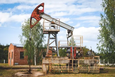
Undocumented orphaned oil and gas wells scattered across the United States pose significant environmental and climate risks, with potential leaks contaminating air, water, and emitting methane, a potent greenhouse gas. Leveraging artificial intelligence (AI), researchers are analyzing historical topographic maps to identify these hidden wells, combining this data with modern tools like drones, sensors, and magnetometers to locate and assess the sites. The AI technology, trained to recognize symbols denoting wells on old maps, has already pinpointed thousands of potential undocumented wells, which are then verified through satellite imagery and fieldwork.
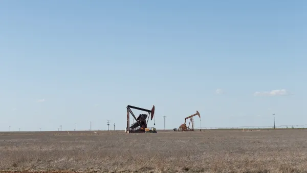
The research is part of the Consortium Advancing Technology for Assessment of Lost Oil & Gas Wells (CATALOG), a collaborative effort among national labs to address the growing issue of orphan wells. Once discovered, these wells are assessed for methane emissions using both high-tech and low-cost sensors to prioritize the most hazardous sites for plugging. This approach not only curbs greenhouse gas emissions but also prevents contaminants like benzene and hydrogen sulfide from endangering nearby ecosystems and communities.
Innovative field tools, such as drones equipped with methane sensors and magnetometers, allow researchers to survey large areas more efficiently than on foot. These technologies are paired with traditional mapping techniques to create a multi-layered approach for uncovering wells. The combination of historical data and cutting-edge equipment ensures even wells buried under decades of development or natural regrowth can be identified and addressed.
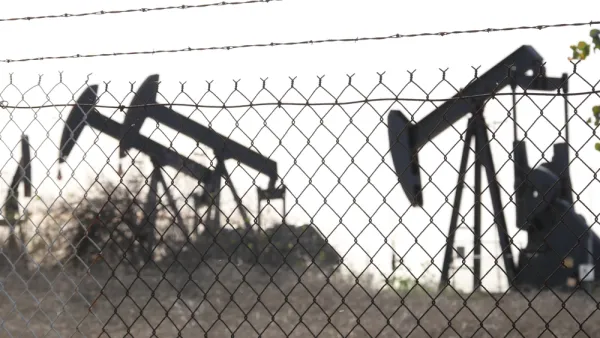
Through partnerships with stakeholders like Native American tribes and federal agencies, CATALOG’s efforts aim to scale these methods nationwide. By integrating diverse datasets and tools, the project seeks to minimize environmental harm from orphan wells, reducing methane emissions and protecting communities from the legacy of early oil and gas exploration.
FULL STORY: AI Helps Researchers Dig Through Old Maps to Find Lost Oil and Gas Wells

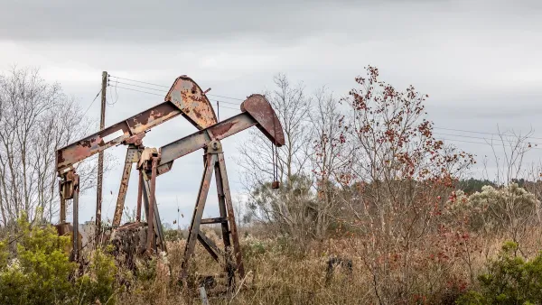
Silent Threat: America’s Abandoned Oil Wells and the Danger Beneath
Abandoned oil and gas wells across the U.S. pose significant environmental, health, and safety risks, with many leaking hazardous gases and chemicals, highlighting regulatory failures and the immense financial burden of remediation.
Healing the Land: Collaborative Effort to Reclaim Orphan Well Sites
The Well Done Foundation and U.S. Fish and Wildlife Service are partnering to plug over 110 orphan wells across four National Wildlife Refuges, restoring habitats, protecting ecosystems, and reducing methane emissions.
Addressing Orphan Wells for Environmental Justice
Remediating and repurposing some orphan oil and gas wells into parks can turn environmental hazards into community assets, promoting health, environmental justice, and accessible green space for underserved areas.

Analysis: Cybertruck Fatality Rate Far Exceeds That of Ford Pinto
The Tesla Cybertruck was recalled seven times last year.

National Parks Layoffs Will Cause Communities to Lose Billions
Thousands of essential park workers were laid off this week, just before the busy spring break season.

Retro-silient?: America’s First “Eco-burb,” The Woodlands Turns 50
A master-planned community north of Houston offers lessons on green infrastructure and resilient design, but falls short of its founder’s lofty affordability and walkability goals.

Test News Post 1
This is a summary

Analysis: Cybertruck Fatality Rate Far Exceeds That of Ford Pinto
The Tesla Cybertruck was recalled seven times last year.

Test News Headline 46
Test for the image on the front page.
Urban Design for Planners 1: Software Tools
This six-course series explores essential urban design concepts using open source software and equips planners with the tools they need to participate fully in the urban design process.
Planning for Universal Design
Learn the tools for implementing Universal Design in planning regulations.
EMC Planning Group, Inc.
Planetizen
Planetizen
Mpact (formerly Rail~Volution)
Great Falls Development Authority, Inc.
HUDs Office of Policy Development and Research
NYU Wagner Graduate School of Public Service