


A team of researchers is developing a dataset to fill a critical gap in self-driving cars’ learning models.

Researchers at the University of Maryland are working to make autonomous vehicles safer for blind pedestrians, reports Laurie Robinson in Maryland Today. According to the researchers, autonomous cars lack “solid data” for how blind pedestrians move and navigate streets and sidewalks.
“The oversight can hinder the ability of autonomous vehicles to safely predict the movements of blind pedestrians, whose behaviors, such as using a cane to feel the curbs or veering, might confuse current models, leading to potentially dangerous errors.” The research team is creating a dataset called BlindWays that uses real-world 3D motion-capture data to help the systems understand blind pedestrians more effectively.
In testing, the model reduced prediction errors by over 80 percent in some cases. “To enhance and expand the BlindWays dataset, the researchers plan to collaborate with organizations specializing in disability rights, mobility training and urban planning. These partnerships aim to diversify participants, locations and scenarios in the dataset.”
FULL STORY: Autonomous Cars Don’t Understand How Blind People Move Around. A Research Team Is Trying to Boost Safety.

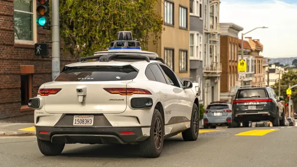
Waymo Robotaxis Often Fail to Stop for Pedestrians
One journalist recorded more than a dozen instances of Waymo autonomous cars speeding by when he tried to cross the street.
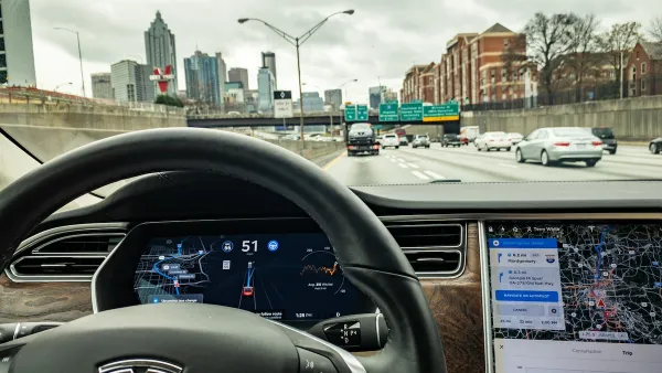
NHTSA Opens Investigation Into Tesla’s Autonomous System
The agency will probe the “Full Self-Driving” system in the wake of crashes that include a pedestrian death.
California Governor Vetoes Autonomous Truck Ban, Approves New Guidelines for AVs
A new law will allow police to issue citations to self-driving car operators and create stricter guidelines for crashes and interactions with first responders.

National Parks Layoffs Will Cause Communities to Lose Billions
Thousands of essential park workers were laid off this week, just before the busy spring break season.

Retro-silient?: America’s First “Eco-burb,” The Woodlands Turns 50
A master-planned community north of Houston offers lessons on green infrastructure and resilient design, but falls short of its founder’s lofty affordability and walkability goals.

Delivering for America Plan Will Downgrade Mail Service in at Least 49.5 Percent of Zip Codes
Republican and Democrat lawmakers criticize the plan for its disproportionate negative impact on rural communities.

Test News Post 1
This is a summary

Test News Headline 46
Test for the image on the front page.

Balancing Bombs and Butterflies: How the National Guard Protects a Rare Species
The National Guard at Fort Indiantown Gap uses GIS technology and land management strategies to balance military training with conservation efforts, ensuring the survival of the rare eastern regal fritillary butterfly.
Urban Design for Planners 1: Software Tools
This six-course series explores essential urban design concepts using open source software and equips planners with the tools they need to participate fully in the urban design process.
Planning for Universal Design
Learn the tools for implementing Universal Design in planning regulations.
EMC Planning Group, Inc.
Planetizen
Planetizen
Mpact (formerly Rail~Volution)
Great Falls Development Authority, Inc.
HUDs Office of Policy Development and Research
NYU Wagner Graduate School of Public Service