


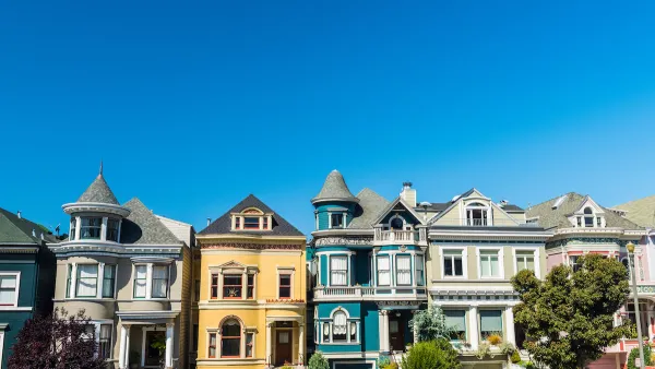
It has been a few years since my last trip to Europe, so perhaps I have selective memory. But I don’t recall having to compete with hundreds of cars or choke down exhaust while exploring the streets of London. I remember navigating through seas of people that filled the city’s squares, alleyways and boulevards.
It has been a few years since my last trip to Europe, so perhaps I have selective memory. But I don't recall having to compete with hundreds of cars or choke down exhaust while exploring the streets of London. I remember navigating through seas of people that filled the city's squares, alleyways and boulevards.
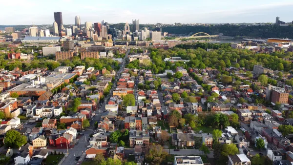
Some of the world's most walkable cities, like London, New York and San Francisco, are actually hostile territory for drivers. As a result, people get around on foot, by cab or via mass transit.
Through a positive feedback loop, pedestrians abound in neighborhoods where walking is much more pleasant than driving. Walkable communities tend to limit traffic volume, which creates a more enjoyable, safe and healthy streetscape, which in turn attracts more pedestrians. In autocentric communities, on the other hand, it is usually easiest to just hop in the car.
The Charter of the New Urbanism asserts that "communities should be designed for the pedestrian and transit as well as the car". This is a noble goal, and many new developments in California (both New Urbanist and others) offer rail access and a network of sidewalks. The challenge has been the "as well as the car" clause. In southern California, planners are bending over backwards to accommodate a rapidly increasing number of vehicles. In an effort to keep traffic flowing smoothly, they are building even wider roads and larger parking lots, making things way too easy for drivers. They are by default creating autocentric environments, regardless of the number of sidewalks included. Multi-lane arterials are about as inviting to pedestrians as sidewalk-rimmed freeways.
So, is there a way to "acknowledge the car" without constructing enormous suburban throughways? While reducing car use sounds cliché, planners do need to provide some disincentives for driving. For example, the City of Berkeley provides very limited parking, both downtown and near the University of California campus. After about a week of driving in circles and $40 parking tickets, new residents soon learn that it is much easier to walk, bike or take the bus. Because so many residents use alternate means of transportation, traffic is usually not gridlocked, even though most streets are quite narrow. Berkeley also has a good old-fashioned urban street grid, which serves to diffuse traffic among countless side streets (all of which are walkable, by the way).
One encouraging sign is the "New Alternatives to Arterials" workshop that was held last fall in Boulder, CO, currently featured in an article on the Congress for the New Urbanism home page. The article concedes that these high-speed roadways are entirely inconsistent with pedestrian-friendly streets.

Two Cheers For the Planners’ Pledge
A “Planners’ Pledge” created by some of the leading authorities on planning sets forth a bold urbanist agenda- even if not every idea in the pledge is equally useful in all cities.
A Better Understanding of Smart Growth Benefits
Smart Growth creates compact, multimodal communities where residents consume less land, drive less, and rely more on non-auto modes. Planners have important stories to tell about the benefits of Smart Growth.
200-Acre Traditional Neighborhood Development Coming to Northwest Arkansas
A local group recently completed the purchase of 200 acres near Rogers, in Benton County, Arkansas, that will become a master-planned, mixed-use neighborhood called Warren Park.

Analysis: Cybertruck Fatality Rate Far Exceeds That of Ford Pinto
The Tesla Cybertruck was recalled seven times last year.

National Parks Layoffs Will Cause Communities to Lose Billions
Thousands of essential park workers were laid off this week, just before the busy spring break season.

Retro-silient?: America’s First “Eco-burb,” The Woodlands Turns 50
A master-planned community north of Houston offers lessons on green infrastructure and resilient design, but falls short of its founder’s lofty affordability and walkability goals.

Test News Post 1
This is a summary

Analysis: Cybertruck Fatality Rate Far Exceeds That of Ford Pinto
The Tesla Cybertruck was recalled seven times last year.

Test News Headline 46
Test for the image on the front page.
Urban Design for Planners 1: Software Tools
This six-course series explores essential urban design concepts using open source software and equips planners with the tools they need to participate fully in the urban design process.
Planning for Universal Design
Learn the tools for implementing Universal Design in planning regulations.
EMC Planning Group, Inc.
Planetizen
Planetizen
Mpact (formerly Rail~Volution)
Great Falls Development Authority, Inc.
HUDs Office of Policy Development and Research
NYU Wagner Graduate School of Public Service