


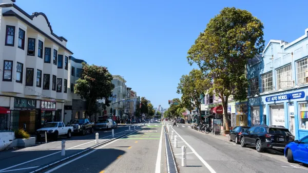
Officials in San Francisco are floating a plan that would add 34 more miles of bike lanes to the city, nearly doubling its current stock. The addition would require the removal of street parking and could take over some traffic lanes.
"San Francisco bicyclists would be able to ride on 34 miles of new bike lanes - routes that would, in some cases, mean a loss of curbside automobile parking and traffic lanes, under a plan being circulated by city officials."
"The plan would nearly double the city's existing network of bike lanes, which cover 44 miles of city streets."
"Some would require the removal of street parking and traffic lanes, or the narrowing of traffic lanes."
"The recommendations are aimed at updating San Francisco's 1997 bicycle plan, a document that is required to make the city eligible for regional, state and federal grants."
"In addition to creating new lanes, the new proposal calls for the creation of more secure bicycle parking. It also suggests starting a pilot project that would allow bikes on the Municipal Railway light-rail system and stepping up enforcement and penalties against motorists who illegally double-park in designated bike lanes."
FULL STORY: New S.F. bike plan would add 34 miles of lanes

Progress for San Francisco's Ambitious Bike Plans
Ariel Rosenstock updates San Francisco's progress in implementing the vision set forth by the 2009 San Francisco Bicycle Plan.
After Years of Delays, San Francisco's Bike Plan Hits the Street
Delayed from implementation for four years, San Francisco's bicycle plan has been legally ruled into action. The first lanes are being painted.
How San Francisco’s ‘People Protected Bike Lanes’ are Moving the Needle on Road Safety
A local bike safety protest has become a global phenomenon.

National Parks Layoffs Will Cause Communities to Lose Billions
Thousands of essential park workers were laid off this week, just before the busy spring break season.

Retro-silient?: America’s First “Eco-burb,” The Woodlands Turns 50
A master-planned community north of Houston offers lessons on green infrastructure and resilient design, but falls short of its founder’s lofty affordability and walkability goals.

Delivering for America Plan Will Downgrade Mail Service in at Least 49.5 Percent of Zip Codes
Republican and Democrat lawmakers criticize the plan for its disproportionate negative impact on rural communities.

Test News Post 1
This is a summary

Test News Headline 46
Test for the image on the front page.

Balancing Bombs and Butterflies: How the National Guard Protects a Rare Species
The National Guard at Fort Indiantown Gap uses GIS technology and land management strategies to balance military training with conservation efforts, ensuring the survival of the rare eastern regal fritillary butterfly.
Urban Design for Planners 1: Software Tools
This six-course series explores essential urban design concepts using open source software and equips planners with the tools they need to participate fully in the urban design process.
Planning for Universal Design
Learn the tools for implementing Universal Design in planning regulations.
EMC Planning Group, Inc.
Planetizen
Planetizen
Mpact (formerly Rail~Volution)
Great Falls Development Authority, Inc.
HUDs Office of Policy Development and Research
NYU Wagner Graduate School of Public Service