


New earthquake hazard maps from the U.S. Geological Survey show increased earthquake risk areas beyond typical hotspots like California. Geologists say planners and local officials should react to the maps by updating building codes.
"The maps by the U.S. Geological Survey (USGS) reflect the discovery of more earthquake faults in California, a new 7.4-magnitude-quake risk in Utah, as well as more ways to rock the Midwest, South Carolina and the Pacific Northwest than you can shake a stick at."
"Unlike last week's forecast of possible ruptures along faults in California, the National Seismic Hazard Maps calculate the likely intensity of shaking at any given location -- caused by any regional fault giving way -- over a period of 50 years."
"As a result, the new maps are vital for updating local building codes and a direct response to the old geologist truism: Earthquakes don't kill people, buildings kill people."
FULL STORY: Shaky U.S. Grounds Revealed in New Maps

When the Earth Turns to Liquid
A 7.5 magnitude earthquake struck the Indonesian island of Sulawesi on Sept. 25, followed by a massive tsunami. Soil liquefaction caused by the tremor resulted in 1,700 homes being "swallowed" as the soil shifted. Deaths exceeded 1,400 on Oct. 3.
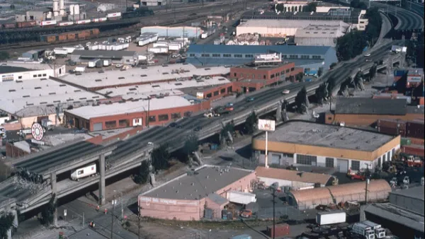
Bay Area Not Prepared for Next Big One
As the death toll from Mexico's 7.1 magnitude earthquake on Sept. 19 climbs above 300, the San Francisco Chronicle investigates how well prepared the Bay Area is for an earthquake of comparable magnitude. Not very well.
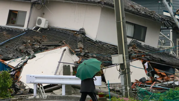
Mexico City Earthquake Should Raise Questions About Building Safety
The epicenter of Tuesday's quake was in the state of Puebla, 80 miles southeast of Mexico City. Soft soil and unreinforced buildings magnified the damage. The quake comes two weeks after an 8.1 quake struck off the coast of the state of Oaxaca.

Analysis: Cybertruck Fatality Rate Far Exceeds That of Ford Pinto
The Tesla Cybertruck was recalled seven times last year.

National Parks Layoffs Will Cause Communities to Lose Billions
Thousands of essential park workers were laid off this week, just before the busy spring break season.

Retro-silient?: America’s First “Eco-burb,” The Woodlands Turns 50
A master-planned community north of Houston offers lessons on green infrastructure and resilient design, but falls short of its founder’s lofty affordability and walkability goals.

Test News Post 1
This is a summary

Analysis: Cybertruck Fatality Rate Far Exceeds That of Ford Pinto
The Tesla Cybertruck was recalled seven times last year.

Test News Headline 46
Test for the image on the front page.
Urban Design for Planners 1: Software Tools
This six-course series explores essential urban design concepts using open source software and equips planners with the tools they need to participate fully in the urban design process.
Planning for Universal Design
Learn the tools for implementing Universal Design in planning regulations.
EMC Planning Group, Inc.
Planetizen
Planetizen
Mpact (formerly Rail~Volution)
Great Falls Development Authority, Inc.
HUDs Office of Policy Development and Research
NYU Wagner Graduate School of Public Service