


In an effort to recreate sprawling Tysons Corner into a dense urban environment, county supervisors have unanimously approved a plan to build higher, denser, more transit oriented and more walkable.
"Supervisors unanimously approved a blueprint that was more than three years in the making. It hinges on giving landowners broad new permission to build city-style high-rises with urban-scale streets, sidewalks, restaurants and shops. It depends on the expected construction of four Metrorail stations in Tysons and is expected to take several decades before it is fully implemented."
"The Tysons Land Use Task Force recommended creating eight distinct neighborhoods within Virginia's largest jobs center, which is now a sprawling ocean of parking lots, office parks and shopping malls. The model acknowledges that the four huge highways that traverse Tysons -- routes 7 and 123, the Capital Beltway and the Dulles Toll Road -- are not going to change. But it opens up the possibility of creating smaller-scale urban districts in Tysons with the look and feel of true cities, supporters of the plan said."
"The task force also recommended allowing developers to build the highest, densest offices and condos within one-eighth of a mile of the four planned Metro stations. That density is likely to be one of the most controversial aspects of the recommendations because many residents fear even more traffic at Tysons and the surrounding neighborhoods."
FULL STORY: Green City-Style Tysons Plan Wins Fairfax's Approval

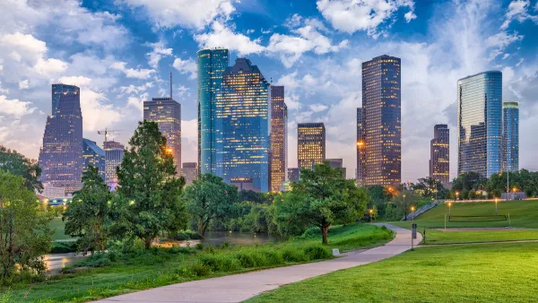
Promoting Infill Development for a Denser Houston
An advocacy group is calling for ‘sustainable, vertical’ mixed-use urbanism in the famously sprawling city.
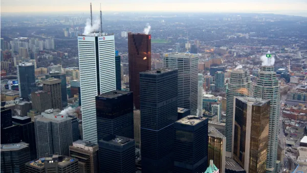
Growth Plan Debate Heats Up in Toronto
The question of how and where to grow is causing controversy in Toronto. A recent op-ed picks a side.
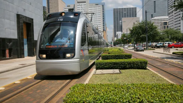
Two Studies Show How Light Rail Benefits Houston
Finally, the city seems to be reaping benefits from a major investment in public transportation.

National Parks Layoffs Will Cause Communities to Lose Billions
Thousands of essential park workers were laid off this week, just before the busy spring break season.

Retro-silient?: America’s First “Eco-burb,” The Woodlands Turns 50
A master-planned community north of Houston offers lessons on green infrastructure and resilient design, but falls short of its founder’s lofty affordability and walkability goals.

Delivering for America Plan Will Downgrade Mail Service in at Least 49.5 Percent of Zip Codes
Republican and Democrat lawmakers criticize the plan for its disproportionate negative impact on rural communities.

Test News Post 1
This is a summary

Test News Headline 46
Test for the image on the front page.

Balancing Bombs and Butterflies: How the National Guard Protects a Rare Species
The National Guard at Fort Indiantown Gap uses GIS technology and land management strategies to balance military training with conservation efforts, ensuring the survival of the rare eastern regal fritillary butterfly.
Urban Design for Planners 1: Software Tools
This six-course series explores essential urban design concepts using open source software and equips planners with the tools they need to participate fully in the urban design process.
Planning for Universal Design
Learn the tools for implementing Universal Design in planning regulations.
EMC Planning Group, Inc.
Planetizen
Planetizen
Mpact (formerly Rail~Volution)
Great Falls Development Authority, Inc.
HUDs Office of Policy Development and Research
NYU Wagner Graduate School of Public Service