


By mapping rat infestations, New York City's health inspectors have found a whole new way to beat back the rodents.
"Michael Mills, a veteran health inspector in New York City, helps create a map of the city you won't find in any guidebook: a rat map.
The city's rat map was first introduced a year ago, with an intensive pilot program in the Bronx. Mills and other inspectors scoured the streets, building by building, cataloging rat hotspots - places that show so-called active rat signs, such as lived-in burrows, fresh droppings, tell-tale gnaw marks on plastic garbage bags - in an effort to target rodent-control measures more effectively. That geocoding information was entered into each inspector's hand-held indexing computer and aggregated with similar data from all across the borough.
Today, rodent complaints by residents from all over New York are electronically pinpointed on the city's computerized rat map, which allows inspectors to track complaints and hotspots over time and determine how well rat-control efforts are working. The results, after just one year, should be music to the ears of most New Yorkers: When the pilot study began in the Bronx, inspectors found active rat signs on 3,100 of the borough's 39,000 properties. Preliminary results now show that 1,250 of those properties are rat-free. That's a 40% dropoff in infestations."
FULL STORY: Mapping the Rats in New York City

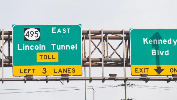
Is Trump’s Reversal of Congestion Pricing Legal?
Gov. Hochul says New York City will “keep its cameras on.” Can the administration legally end the nation's first cordon pricing program?

USDOT Revokes Approval for NYC Congestion Pricing
Despite the administration’s stated concern for the “working class,” 85 percent of Manhattan commuters use public transit to enter the city.
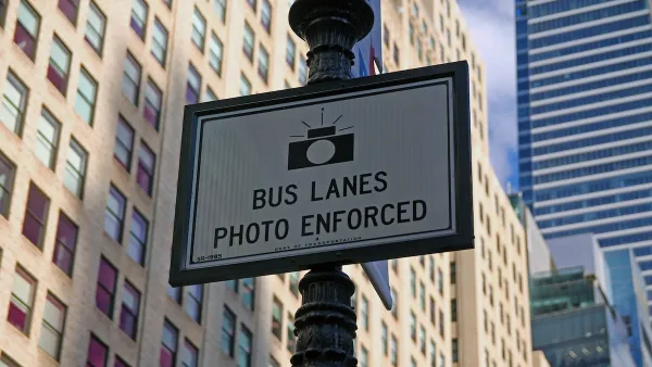
NYC Camera Program Captures 400,000 Bus Lane Violations
Bus speeds increased by as much as 25 percent on some routes after enforcement began last August.

Analysis: Cybertruck Fatality Rate Far Exceeds That of Ford Pinto
The Tesla Cybertruck was recalled seven times last year.

National Parks Layoffs Will Cause Communities to Lose Billions
Thousands of essential park workers were laid off this week, just before the busy spring break season.

Retro-silient?: America’s First “Eco-burb,” The Woodlands Turns 50
A master-planned community north of Houston offers lessons on green infrastructure and resilient design, but falls short of its founder’s lofty affordability and walkability goals.

Test News Post 1
This is a summary

Analysis: Cybertruck Fatality Rate Far Exceeds That of Ford Pinto
The Tesla Cybertruck was recalled seven times last year.

Test News Headline 46
Test for the image on the front page.
Urban Design for Planners 1: Software Tools
This six-course series explores essential urban design concepts using open source software and equips planners with the tools they need to participate fully in the urban design process.
Planning for Universal Design
Learn the tools for implementing Universal Design in planning regulations.
EMC Planning Group, Inc.
Planetizen
Planetizen
Mpact (formerly Rail~Volution)
Great Falls Development Authority, Inc.
HUDs Office of Policy Development and Research
NYU Wagner Graduate School of Public Service