


At a company presentation about environmental impact the other week a colleague included a historic photograph of Scollay Square in Boston. You are pardoned if, even after visiting or living in that city, this doesn’t sound familiar because all prominent characteristics of the area were summarily obliterated in the mid-twentieth century to make way for a potpourri of brutalist-style administrative buildings and renamed Government Center. Urban redevelopment arguments aside, the photograph reveals a particularly interesting detail about the function and use of streets virtually erased from our minds over the last century.

At a company presentation about environmental impact the other week a colleague included a historic photograph of Scollay Square in Boston. You are pardoned if, even after visiting or living in that city, this doesn't sound familiar because all prominent characteristics of the area were summarily obliterated in the mid-twentieth century to make way for a potpourri of brutalist-style administrative buildings and renamed Government Center. Urban redevelopment arguments aside, the photograph reveals a particularly interesting detail about the function and use of streets virtually erased from our minds over the last century.
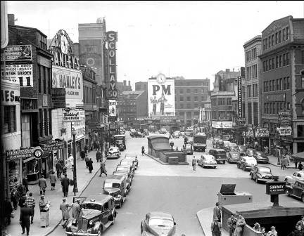
In the center and bottom-right corner of the scene are subway headhouses, smack-dab in the middle of the street. Although Scollay Square is full of cars in this photo, it is clear that the configuration allows, or more accurately expects people to walk in and along the street to access the subway. Several people can be seen in the middle of the street, unencumbered by crosswalks, pedestrian signals, or medians. This is not a glimpse of utopia, but it certainly demonstrates that the street was once seen as a space for all users, not just for cars. As is the case with many of the contemporary trends in urban land use, the current call for returning to a streetspace environment where the public right-of-way is shared by multiple users is not a new idea. On the contrary, we have only just managed to forget the learned wisdom of thousands of years of urbanity in the Orweillian twilight of a car-culture gone awry. Photos like these, like Winston Smith's glass-encased tidbit of coral, tell of a different and friendlier world.
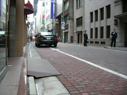
To be fair, one could make the claim that the photo also shows the natural tendency of pedestrians to keep to the sidewalk. True, but I submit that this is the effect of several causes that developed over a period of centuries. First, people tend to gravitate towards the attractive features of storefronts. Second, people tend to gravitate towards people. Third, the faster speed and larger size of horses, horse and buggy carriages, and eventually automobiles gradually pushed pedestrians towards the periphery of streets. Finally, the European design solution for rain and wastewater runoff (think bedpans emptied out of bedroom windows and horses in the hundreds) was the gutter, whereby the raised curb system used to whisk away water and waste resulted in a clean, elevated platform for pedestrians free of mud and puddles, and close to building fronts where there was also often shelter from rain. This last cause can be contrasted against the drainage solution often seen in many Japanese cities where a small channel is provided right in front of the storefront, and a short platform is used to bridge the gap between street and doorway. This alternate design results in a de facto shared street that freely mixes cars and pedestrians in even the most luxurious fashion, such as in Tokyo's glitzy Ginza district (see photo below).
In other words, the function of a sidewalk evolved out of various converging factors unrelated to an explicit attempt to create separate spaces for walking and driving. The domination of the street by cars in the last century is at least partially a result of an innocent tendency of pedestrians to traffic the sidewalk for various reasons, rather than a categorical forfeit of the majority of the public realm to one user-type. In the current, thrilling campaign by planners to return urbanity to something more human scale, a photo memorializing the multiplicitous modal functionality of Scollay Square before its razing is as good a symbol as any for wisdom that must be embraced once again.

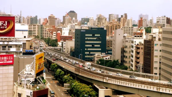
Tokyo Expressway to Become a Linear Park
A major expressway in Ginza will be converted to a park similar to New York City's High Line.
Boston’s Government Center T Station Closed for Access Improvements
Boston recently shut down one of its busiest transit hubs, the Government Center T Station for over-due renovations above and below the ground. The station was originally built in 1898, and without a major renovation since the 1960s.
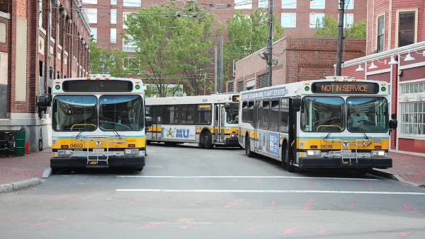
Boston Bus Signal Priority Project Yields Faster Travel Times
The city now plans to expand a year-long pilot project that reduced the time buses waited at traffic signals.

Analysis: Cybertruck Fatality Rate Far Exceeds That of Ford Pinto
The Tesla Cybertruck was recalled seven times last year.

National Parks Layoffs Will Cause Communities to Lose Billions
Thousands of essential park workers were laid off this week, just before the busy spring break season.

Retro-silient?: America’s First “Eco-burb,” The Woodlands Turns 50
A master-planned community north of Houston offers lessons on green infrastructure and resilient design, but falls short of its founder’s lofty affordability and walkability goals.

Test News Post 1
This is a summary

Analysis: Cybertruck Fatality Rate Far Exceeds That of Ford Pinto
The Tesla Cybertruck was recalled seven times last year.

Test News Headline 46
Test for the image on the front page.
Urban Design for Planners 1: Software Tools
This six-course series explores essential urban design concepts using open source software and equips planners with the tools they need to participate fully in the urban design process.
Planning for Universal Design
Learn the tools for implementing Universal Design in planning regulations.
EMC Planning Group, Inc.
Planetizen
Planetizen
Mpact (formerly Rail~Volution)
Great Falls Development Authority, Inc.
HUDs Office of Policy Development and Research
NYU Wagner Graduate School of Public Service