


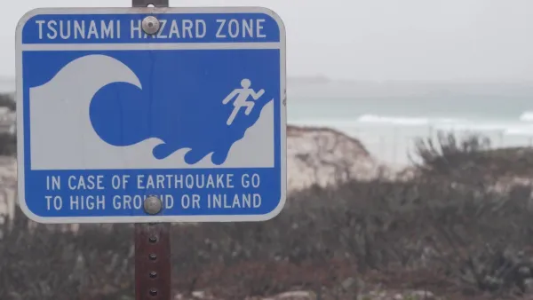
The event of a huge earthquake off the Aleutian Islands could send a devastating tsunami towards the West coast of the U.S. Researchers have released maps of what a worst-case scenario might look like for coastal communities.
"The danger has long been known, but Thursday a team of state scientists and emergency management specialists announced they have completed an updated series of 135 "inundation maps" covering shoreline areas in the state's 30 coastal counties and every harbor and inlet that could be threatened.
The maps reveal in detail just how far large tsunamis might send ocean waters rushing inland to threaten beaches and coastal towns. They also indicate evacuation routes that lead to higher ground. The maps are being released online today by the California Emergency Management Agency."
Waves could rise more than 20 feet, inundating many of the state's coastal cities.
FULL STORY: Maps show where tsunami floods would hit state

Washington State Requests Federal Funding for Tsunami Preparedness
The state’s Department of Natural Resources says it needs continued funding to map coastal areas at risk for tsunami impacts and prepare mitigation and evacuation plans.
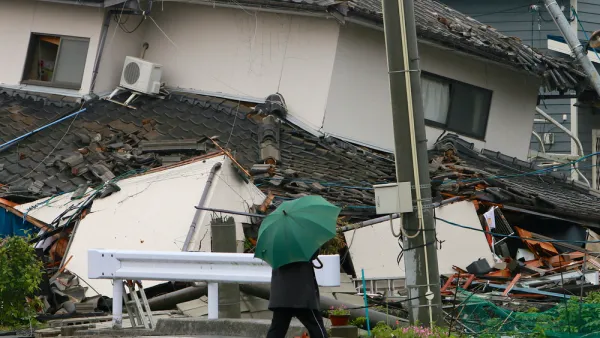
When the Earth Turns to Liquid
A 7.5 magnitude earthquake struck the Indonesian island of Sulawesi on Sept. 25, followed by a massive tsunami. Soil liquefaction caused by the tremor resulted in 1,700 homes being "swallowed" as the soil shifted. Deaths exceeded 1,400 on Oct. 3.
The Scary, Likely Event of the 'Really Big One' in the Pacific Northwest
Forget Hollywood's proclivity for destroying Los Angeles and San Francisco in movies like San Andreas—the greatest seismic threat in North America is in the Pacific Northwest.

National Parks Layoffs Will Cause Communities to Lose Billions
Thousands of essential park workers were laid off this week, just before the busy spring break season.

Retro-silient?: America’s First “Eco-burb,” The Woodlands Turns 50
A master-planned community north of Houston offers lessons on green infrastructure and resilient design, but falls short of its founder’s lofty affordability and walkability goals.

Delivering for America Plan Will Downgrade Mail Service in at Least 49.5 Percent of Zip Codes
Republican and Democrat lawmakers criticize the plan for its disproportionate negative impact on rural communities.

Test News Post 1
This is a summary

Test News Headline 46
Test for the image on the front page.

Balancing Bombs and Butterflies: How the National Guard Protects a Rare Species
The National Guard at Fort Indiantown Gap uses GIS technology and land management strategies to balance military training with conservation efforts, ensuring the survival of the rare eastern regal fritillary butterfly.
Urban Design for Planners 1: Software Tools
This six-course series explores essential urban design concepts using open source software and equips planners with the tools they need to participate fully in the urban design process.
Planning for Universal Design
Learn the tools for implementing Universal Design in planning regulations.
EMC Planning Group, Inc.
Planetizen
Planetizen
Mpact (formerly Rail~Volution)
Great Falls Development Authority, Inc.
HUDs Office of Policy Development and Research
NYU Wagner Graduate School of Public Service