


I’m going to riff off a recent Interchange Blog post by Michael Lewyn on the relationship between mobility and accessibility. Given the positive comments from the planning community to Michael’s post, a little engagement may be necessary for both clarity as well as fully understanding the implications of reading too much into the accessibility versus mobility debate.

I'm going to riff off a recent Interchange Blog post by Michael Lewyn on the relationship between mobility and accessibility. Given the positive comments from the planning community to Michael's post, a little engagement may be necessary for both clarity as well as fully understanding the implications of reading too much into the accessibility versus mobility debate.
Michael makes a welcome attempt to clarify the distinction between the two terms, but I think he's incorrect when he concludes his post, after criticizing planning in "auto-dependent" suburbs: "It logically follows that mobility for all is highest in places that accommodate pedestrians, transit users, and bicyclists as well as drivers- in other words, that accessibility is mobility." As the author of two books on transportation policy, and one titled Mobility First, I'll beg to dissent-somewhat.
For the record, I agree completely with the observation that the terms "mobility" and "accessibility" are confused in the planning discourse, with the term mobility often incorrectly tied to automobile travel as if mobility should be dismissed or reduced. This is unfortunate.
Mobility, as Michael correctly notes, is about moving people and goods from place-to-place. Higher mobility is good for society and cities (as I discuss in Chapter 3 of Mobility First.) Accessibility is something that is easily approached, entered, obtainable, or attained. Greater accessibility is also good for society and cities. Achieving one doesn't necessarily imply giving up the other. The two terms should not be conflated, in either common usage or in urban planning discourse. Mobility provides access, but it is not access. Also, accessibility does not provide mobility.
The automobile, in contrast, is a transportation technology, a method for obtaining things people desire. Cars are, in this respect, no different from busses, taxis, bicycles, or even our feet in the context of mobility (and more broadly accessibility). Each of these technologies has functional advantages and disadvantages. The choice, and even preference for, one transportation technology over another is driven by the desire for mobility and its ability to provide as a means for accessing the goods and services we want.
Unfortunately, by conflating mobility, accessibility and transportation modes, we leave out the crucial discussion of the trade offs implied by consciously shifting from one transportation mode to another. Simply adding transportation modes to an existing built environment will not necessarily increase mobility or accessibility. If the buses run empty, and bicycle paths go unused, the provision of these alternative modes provides neither greater mobility nor greater access. Indeed, by shifting resources from more productive public investments, including greater capacity for the modes that make sense, overall accessibility may decline.
Thus, in the ongoing discussion in the planning profession about mobility and accessibility, a crucial question is what transportation modes need to be in what places and at what times in the neighborhood development cycle. Not all modes are created, or function, equally. Putting the wrong modes in the wrong place may compromise the healthy development of communities.


Zoning for Good
A new book highlights the power of zoning to change communities for the better.
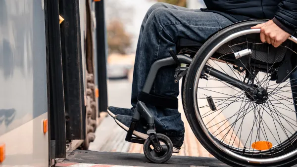
How to Improve Transit Accessibility
Over 13 million Americans face mobility challenges that limit their travel experience.

Website Streamlines Michigan Transit Information
The tool is designed to help people with disabilities navigate the state’s complex public transit network.

National Parks Layoffs Will Cause Communities to Lose Billions
Thousands of essential park workers were laid off this week, just before the busy spring break season.

Retro-silient?: America’s First “Eco-burb,” The Woodlands Turns 50
A master-planned community north of Houston offers lessons on green infrastructure and resilient design, but falls short of its founder’s lofty affordability and walkability goals.

Delivering for America Plan Will Downgrade Mail Service in at Least 49.5 Percent of Zip Codes
Republican and Democrat lawmakers criticize the plan for its disproportionate negative impact on rural communities.

Test News Post 1
This is a summary

Test News Headline 46
Test for the image on the front page.

Balancing Bombs and Butterflies: How the National Guard Protects a Rare Species
The National Guard at Fort Indiantown Gap uses GIS technology and land management strategies to balance military training with conservation efforts, ensuring the survival of the rare eastern regal fritillary butterfly.
Urban Design for Planners 1: Software Tools
This six-course series explores essential urban design concepts using open source software and equips planners with the tools they need to participate fully in the urban design process.
Planning for Universal Design
Learn the tools for implementing Universal Design in planning regulations.
EMC Planning Group, Inc.
Planetizen
Planetizen
Mpact (formerly Rail~Volution)
Great Falls Development Authority, Inc.
HUDs Office of Policy Development and Research
NYU Wagner Graduate School of Public Service