


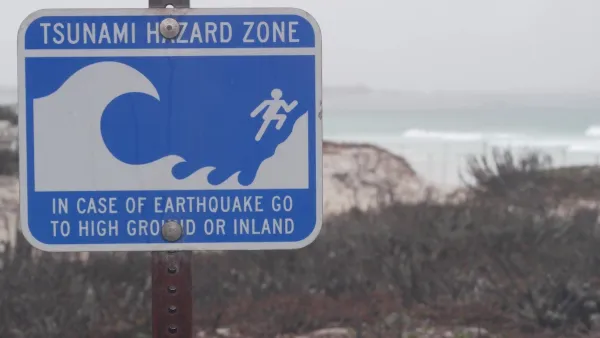
California has just completed a landmark effort to assess the state's worst-case tsunami danger. Now emergency response officials, and even some planners, are considering how to keep the state's coastal populations safe.
"Approximating maximum inundation for a worst-case scenario tsunami, the line washes over all of Newport Bay and Marina del Rey, wipes out parts of downtown Santa Cruz, and makes half of Seal Beach disappear. Some of the state's most fabled real estate from La Jolla to Malibu to Montecito would wash out with the tide. It would yet again pummel Crescent City, itself the victim of the nation's most destructive and deadly recorded tsunami, a 20-foot wave that struck on Good Friday, 1964."
"The maps assign to the tsunami threat a visual element that is absent from the prediction of earthquakes. Contrary to this discomfiting picture, however, researchers and state officials alike caution that the maps' projections in no way mean that the state's coastal communities and nearly 1 million coastal residents should permanently decamp for higher ground."
"Memories of the 2004 south Asian tsunami -- and of the statewide warnings that were sounded after the February 25 Chilean earthquake -- make clear the destructive threat of tsunamis. The maps were prompted by recommendations in a 2005 risk assessment report published by the state Seismic Safety Commission. That report, which was prompted by the south Asian event, noted that roughly 80 tsunamis have struck California over the past 150 years and that two of them were destructive."
Thanks to Josh Stephens
FULL STORY: New Tsunami Maps Depict Extreme High-Water Mark

Washington State Requests Federal Funding for Tsunami Preparedness
The state’s Department of Natural Resources says it needs continued funding to map coastal areas at risk for tsunami impacts and prepare mitigation and evacuation plans.

Austin Text Alert System Caters to Unhoused Residents
A new emergency text message alert system will provide information specific to the needs of homeless people during extreme weather events.

California Regulators Require Parking Replacement for Outdoor Dining Spaces
The city of San Diego’s Spaces as Places outdoor dining program includes a critical parking requirement mandated by the California Coastal Commission.

Analysis: Cybertruck Fatality Rate Far Exceeds That of Ford Pinto
The Tesla Cybertruck was recalled seven times last year.

National Parks Layoffs Will Cause Communities to Lose Billions
Thousands of essential park workers were laid off this week, just before the busy spring break season.

Retro-silient?: America’s First “Eco-burb,” The Woodlands Turns 50
A master-planned community north of Houston offers lessons on green infrastructure and resilient design, but falls short of its founder’s lofty affordability and walkability goals.

Test News Post 1
This is a summary

Analysis: Cybertruck Fatality Rate Far Exceeds That of Ford Pinto
The Tesla Cybertruck was recalled seven times last year.

Test News Headline 46
Test for the image on the front page.
Urban Design for Planners 1: Software Tools
This six-course series explores essential urban design concepts using open source software and equips planners with the tools they need to participate fully in the urban design process.
Planning for Universal Design
Learn the tools for implementing Universal Design in planning regulations.
EMC Planning Group, Inc.
Planetizen
Planetizen
Mpact (formerly Rail~Volution)
Great Falls Development Authority, Inc.
HUDs Office of Policy Development and Research
NYU Wagner Graduate School of Public Service